drawing, print, ink, pen, engraving
#
drawing
#
baroque
# print
#
pen sketch
#
ink
#
pen work
#
pen
#
cityscape
#
history-painting
#
engraving
Dimensions: height 212 mm, width 282 mm
Copyright: Rijks Museum: Open Domain
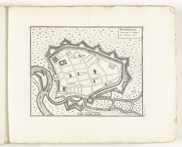
This is an anonymous map of Fort Louis, made around 1702. The delicate lines and muted tones present a bird's-eye view of the fortress. The composition is structured around geometric shapes: the star-shaped fort at the center, the rectangles of buildings, and the curving lines of the river. The map is more than a geographical document. It presents a formal exercise in power and control through its structured design. The fort's star shape, a common military design, radiates outward, visually asserting dominance over the surrounding landscape. The river acts as both a natural boundary and a strategic element, its curves reinforcing the fort's insularity. Consider how the map uses visual language to communicate power. The clean lines and orderly arrangement suggest a rational, controlled space, reflecting the Enlightenment's emphasis on reason and order. This map serves as a reminder that even seemingly objective representations are embedded with cultural and philosophical meanings.
Comments
No comments
Be the first to comment and join the conversation on the ultimate creative platform.
More like this