#
aged paper
#
toned paper
#
pen sketch
#
old engraving style
#
sketch book
#
personal sketchbook
#
pen-ink sketch
#
pen work
#
sketchbook drawing
#
sketchbook art
Dimensions: height 220 mm, width 279 mm
Copyright: Rijks Museum: Open Domain
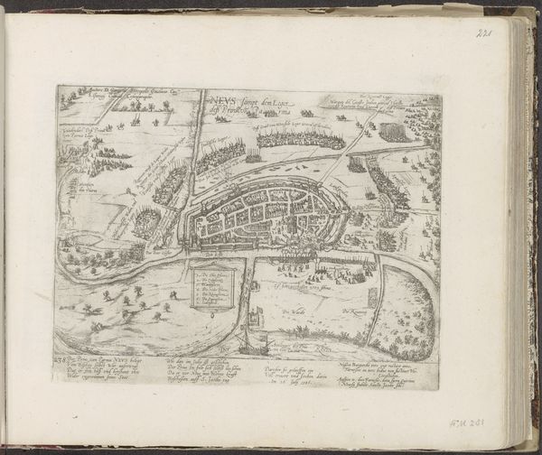
This is an anonymous map of Dieppe, created in 1726. Immediately, you're struck by the dominance of line: it defines every feature, from the curves of the river to the regimented ships at sea. The composition neatly divides the space into zones. The upper section, dominated by the sea and sky, contrasts sharply with the intricate details of the town below. This reflects a period when cartography wasn't just about geographic accuracy; it was a form of symbolic representation. The map is not merely a depiction of space, it's a carefully constructed representation of power and order. The rigid lines and measured proportions suggest a desire to control and understand the world through a rational, structured lens. The map’s structure creates a dialogue about humanity's relationship to its environment. It's a fascinating look at how we use form to impose meaning on the world around us.
Comments
No comments
Be the first to comment and join the conversation on the ultimate creative platform.
More like this