drawing, print, ink, engraving
#
drawing
# print
#
pen sketch
#
perspective
#
ink
#
geometric
#
cityscape
#
history-painting
#
engraving
Dimensions: height 198 mm, width 280 mm
Copyright: Rijks Museum: Open Domain
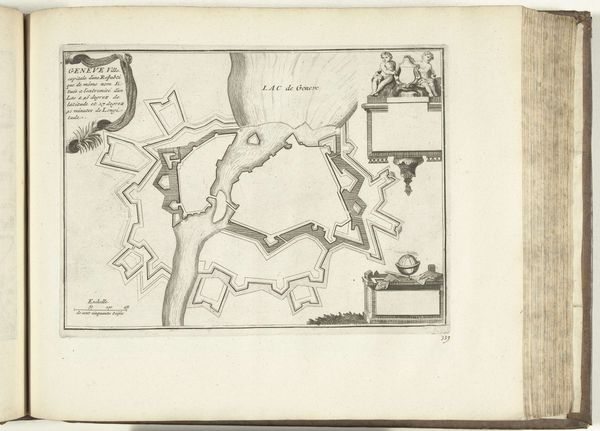
This is Laurens Scherm's 1726 map of Charleroi, rendered with the precision of a cartographer's pen. The star-shaped fortress, a recurring motif in military architecture, dominates the composition, a symbol of protection and power. This geometric configuration echoes through history, reminiscent of Leonardo da Vinci's fortification designs, where the star fort also appears. These shapes are more than mere defensive structures; they resonate with a deeper, perhaps subconscious, human desire for order and control amidst chaos. We see them in mandalas, in town squares, in the layout of utopian cities imagined by Renaissance thinkers. The act of mapping itself, organizing space into comprehensible forms, reflects a profound psychological need to structure our world, to defend against the unknown. As you gaze upon this map, consider how the impulse to create boundaries—both physical and symbolic—shapes our collective experience. The star fort of Charleroi becomes a mirror reflecting the timeless dance between security and vulnerability.
Comments
No comments
Be the first to comment and join the conversation on the ultimate creative platform.
More like this