drawing, paper, ink, engraving
#
drawing
#
aged paper
#
toned paper
#
baroque
#
sketch book
#
hand drawn type
#
paper
#
personal sketchbook
#
ink
#
geometric
#
pen-ink sketch
#
pen work
#
sketchbook drawing
#
cityscape
#
sketchbook art
#
engraving
#
watercolor
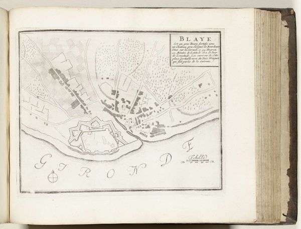
Dimensions: height 230 mm, width 290 mm
Copyright: Rijks Museum: Open Domain
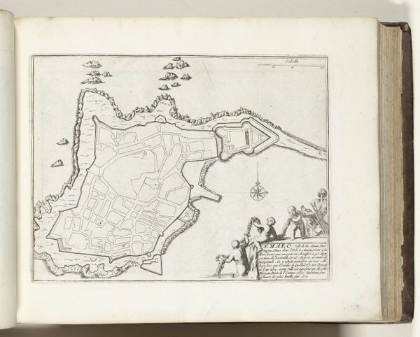
This is an anonymous drawing of Puigcerdá, made with pen and ink, around 1693-1696. Puigcerdá, located in the Pyrenees, has historically been a strategic point. This map, with its detailed rendering of the town’s fortifications, speaks to the region’s military importance and the power struggles of the time. The meticulous details also reflect the values of a society deeply invested in territorial control. Notice how the natural landscape, with its rivers and hills, is carefully documented, offering a contrast between the fluidity of nature and the rigid structures of human control. It invites us to consider how communities are shaped by both the natural world and the social constructs imposed upon them. What stories do these landscapes hold? What does it mean to belong to a place marked by both beauty and conflict?
Comments
No comments
Be the first to comment and join the conversation on the ultimate creative platform.
More like this