drawing, ink
#
drawing
#
baroque
#
ink
#
geometric
#
cityscape
Dimensions: height 231 mm, width 295 mm
Copyright: Rijks Museum: Open Domain
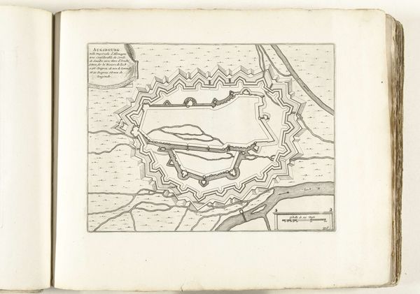
This is an anonymous map of Augsburg, made around 1693 to 1696. At first glance, a detailed city plan might seem purely informational. But consider the era. Augsburg, then a Free Imperial City in the Holy Roman Empire, was a nexus of trade and culture, but also caught in the crosshairs of religious and political conflict. The map is not just a layout; it’s a statement of power and control. Notice the fortifications. They speak to an identity forged in the need for defense, a visual assertion of autonomy in a turbulent world. Who was this map for? Likely, it served the interests of Augsburg’s ruling class, reinforcing their sense of place and authority. Yet, for the everyday citizen, such a map might have evoked a mix of pride and constraint, a reminder of both the city’s strength and the walls that defined their lives. The map of Augsburg is not just ink on paper, it’s a window into the complex interplay of power, identity, and place.
Comments
No comments
Be the first to comment and join the conversation on the ultimate creative platform.
More like this