drawing, ink, pen
#
drawing
#
baroque
#
pen sketch
#
landscape
#
ink
#
geometric
#
pen work
#
pen
#
cityscape
Dimensions: height 231 mm, width 294 mm
Copyright: Rijks Museum: Open Domain
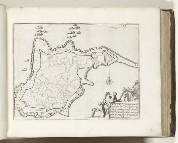
This is a plan of Prats-de-Mollo-la-Preste, made around 1693 to 1696 by an anonymous artist. Executed with ink on paper, the plan presents a bird’s-eye view of a fortified town amidst a rugged landscape. The composition is dominated by geometric forms—the star-shaped fortifications, the angular layout of the town, and the curves of the surrounding terrain, all delineated with a cartographer's precision. The stark contrast between the structured fortifications and the organic, shaded hills introduces a visual tension, highlighting the imposition of human order on the natural world. The line work is precise and economical; its effect is to flatten the image, emphasizing planarity over depth. This interplay between geometry and nature, control and wilderness, speaks to the broader discourse of the era. It challenges the viewer to consider how power is asserted through spatial organization. Note the absence of color, which reduces the plan to its barest essentials, focusing attention on structure and form. This cartographic representation does not merely depict; it interprets, reflecting a world mediated by the concerns of strategy, dominion and knowledge.
Comments
No comments
Be the first to comment and join the conversation on the ultimate creative platform.
More like this