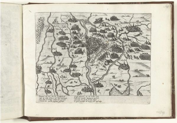
drawing, print, ink, engraving
#
drawing
#
ink drawing
#
pen drawing
# print
#
landscape
#
ink
#
cityscape
#
academic-art
#
engraving
Dimensions: height 439 mm, width 565 mm
Copyright: Rijks Museum: Open Domain
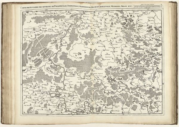
This map of the Roermond and Venlo region was made in 1709 by Jacobus Harrewijn, using engraving techniques. The lines that define the landscape – the rivers, forests, and towns – were incised into a metal plate, likely copper, with a tool called a burin. The character of those lines would have been determined by the artist’s skill, and also by the hardness and grain of the metal. Ink would have been applied to the plate, then wiped away, leaving ink only in the engraved lines. Finally, the plate would have been pressed onto paper, transferring the image. This was a painstaking, labor-intensive process, but one that allowed for multiple, identical impressions to be made. This map is a product of its time, reflecting the growing importance of accurate geographical knowledge for trade, military strategy, and political control. It speaks to the rise of print culture and the dissemination of information, but also to the craft and skill required to create such detailed and precise images.
Comments
No comments
Be the first to comment and join the conversation on the ultimate creative platform.
More like this