print, engraving
#
dutch-golden-age
# print
#
landscape
#
geometric
#
history-painting
#
engraving
Dimensions: height 475 mm, width 555 mm
Copyright: Rijks Museum: Open Domain
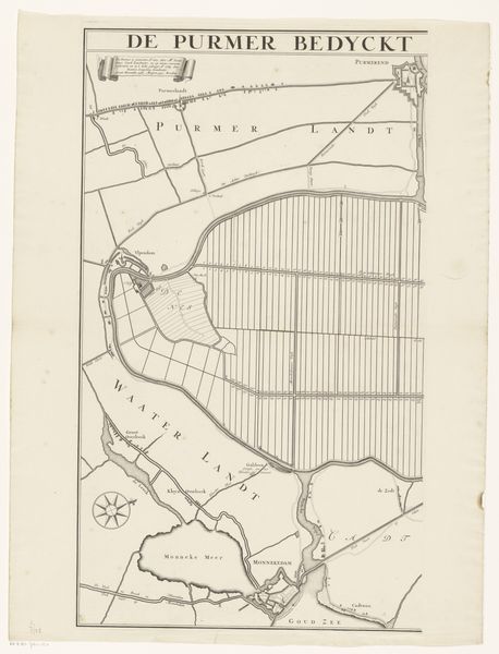
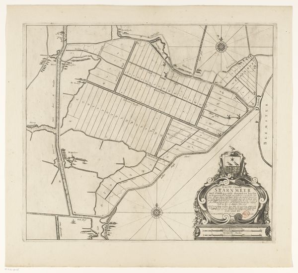
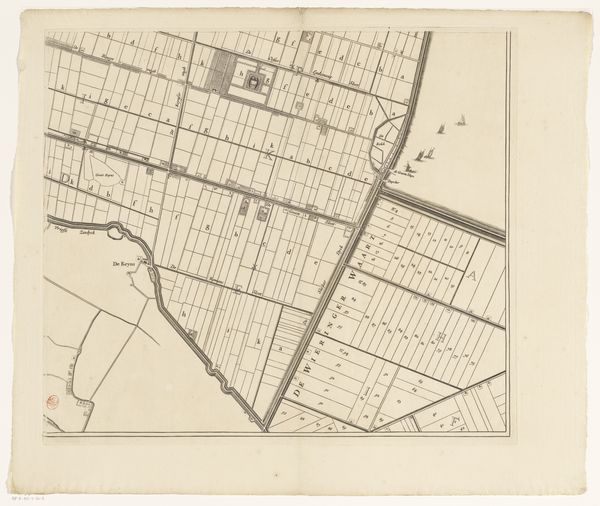
This is a map of the Purmer region, made anonymously. It’s an early example of what we now call ‘polders’ – land reclaimed from the sea. The map is made from ink and watercolor on paper, typical materials for the period. But it represents something quite radical: the large-scale engineering of nature. Look closely, and you’ll see the grid-like pattern imposed on the landscape. These are drainage canals, essential for keeping the land dry and arable. The process of creating polders was incredibly labor-intensive, involving armies of workers using shovels and primitive machinery. It was a massive intervention, reflecting a growing ambition to control the environment for economic gain. The careful rendering of the map itself suggests a desire for order and control. This wasn't just about land reclamation, it was about reshaping the world according to human will. So, while this map may seem like a straightforward depiction of geography, it actually tells a much deeper story about labor, technology, and our evolving relationship with the natural world.
Comments
No comments
Be the first to comment and join the conversation on the ultimate creative platform.
More like this