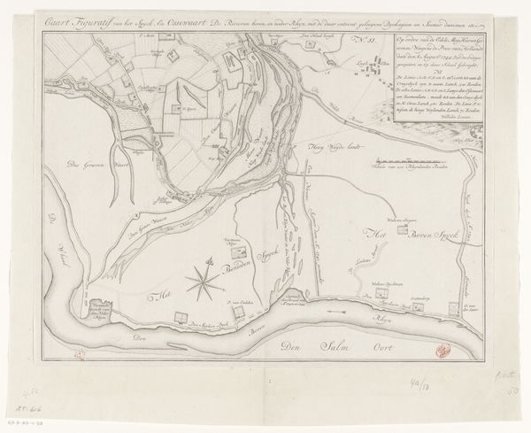
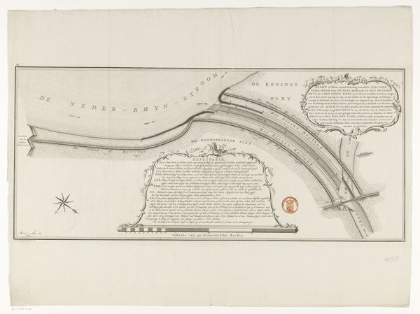
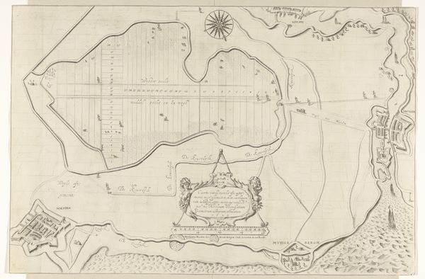
Kaart van het gebied rond de Waal van Schenkenschanz tot aan het Pannerdensch Kanaal 1754
0:00
0:00
drawing, print, paper, ink, engraving
#
drawing
#
baroque
#
dutch-golden-age
# print
#
pen illustration
#
landscape
#
paper
#
ink
#
geometric
#
pen-ink sketch
#
pen work
#
cityscape
#
engraving
Dimensions: height 310 mm, width 728 mm
Copyright: Rijks Museum: Open Domain
This is an anonymous map of the Waal river area, rendered with ink, that presents the landscape as a theater of human activity and strategic importance. Notice the prominent compass rose, an emblem that transcends mere navigation. Its eight points, each corresponding to a cardinal direction, echo the ancient symbol of the wind rose, a motif found in classical antiquity. The compass rose doesn't only guide sailors; it directs the viewer's gaze, suggesting a desire to master and control the territory depicted. This harkens back to a primal urge to chart our world, turning chaos into comprehensible order. The careful depiction of fortifications and settlements along the river reminds me of the way similar motifs were used throughout centuries. The inclusion of cartouches filled with explanatory text recalls Egyptian hieroglyphs, where images and words combine to convey knowledge and power. This map, therefore, operates on multiple levels, revealing not only the physical landscape but also the psychological landscape of ambition and control. Through images like this, the human desire to understand and control our environment resurfaces time and again, evolving with each new historical context.
Comments
No comments
Be the first to comment and join the conversation on the ultimate creative platform.
More like this