print, etching
#
comic strip sketch
#
baroque
#
mechanical pen drawing
# print
#
pen illustration
#
pen sketch
#
etching
#
old engraving style
#
personal sketchbook
#
pen-ink sketch
#
pen work
#
sketchbook drawing
#
cityscape
#
storyboard and sketchbook work
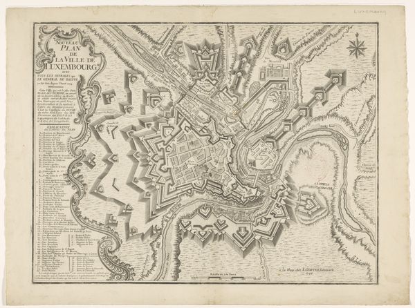
Dimensions: height 385 mm, width 483 mm
Copyright: Rijks Museum: Open Domain
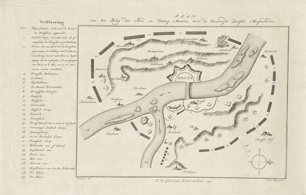
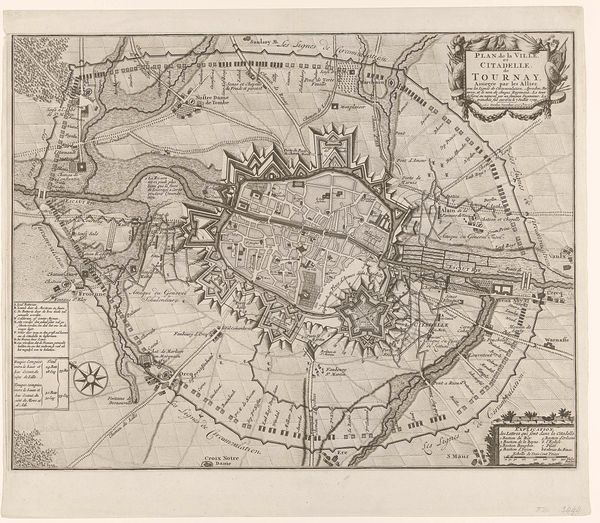
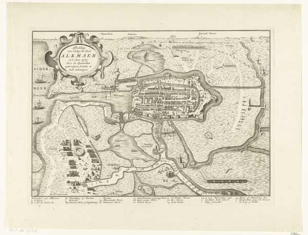
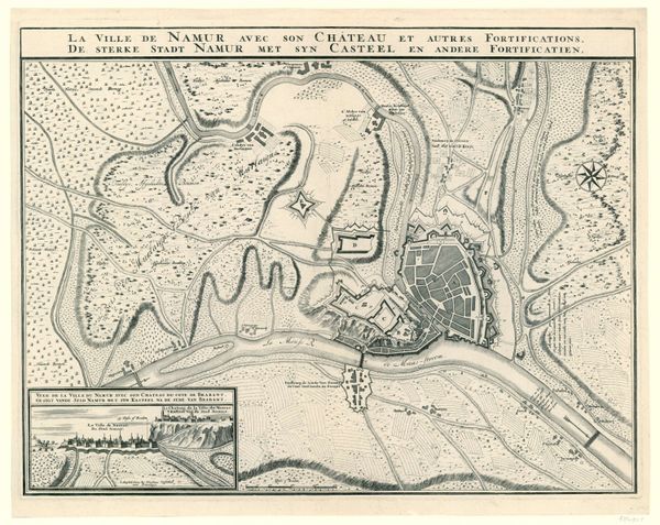
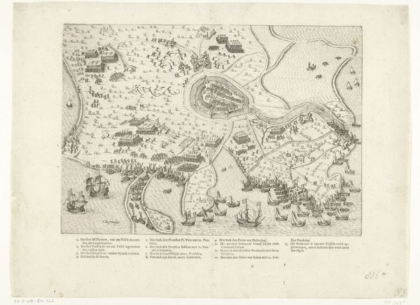
Curator: Before us we have "Plattegrond van de belegering van Praag, 1742", or "Map of the Siege of Prague, 1742", made around 1742 to 1744 by Theodorus Otten, rendered as an etching. It's quite detailed, what's your initial take? Editor: The detail is astounding. Look at the delicate lines, creating such a comprehensive depiction. It has this stark, almost clinical quality to it. You know, a document stripped of emotion yet implicitly filled with conflict. Curator: Absolutely. Otten wasn’t just mapping geography; he was charting power dynamics and lived experience under siege. This map wasn’t an objective, neutral tool; it was likely used to sway opinions and reinforce particular perspectives. Understanding who commissioned and circulated it matters. What was the intended effect of meticulously detailing these troop deployments, strategic choke points? Editor: True, and you can analyze it just as a composition, look at the interplay between the organic lines of the river bisecting the city against the geometrical, assertive positioning of military emplacements. It creates a visual tension—nature versus calculated strategy. The symmetry isn't perfect, yet it strives for order. Curator: Yes, the placement of each line, the weight given to various features. We have to consider the communities impacted and their relationship to spatial control at that time. How does seeing their city laid bare in such a strategic, militaristic way reinforce colonial or hegemonic projects? Where are the voices of the civilians? What’s missing from this so-called objective rendering? Editor: Formally, what strikes me, the lack of aerial perspective flattens the city into a series of signs, and perhaps the real weight resides not in historical experience but on rendering symbolic value to a flat space. This echoes much of structuralist thinking. Curator: But by flattening Prague, it simplifies complex social, political, and lived realities to digestible visual components for those in power. It allows distant strategists to dispassionately calculate gains and losses without acknowledging human consequences on the ground. Editor: In the end, both historical reading and compositional analysis enriches our appreciation. Curator: Precisely, situating aesthetic considerations within a history of colonial mapping is key.
Comments
No comments
Be the first to comment and join the conversation on the ultimate creative platform.
More like this