print, etching
# print
#
etching
#
landscape
#
etching
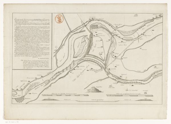
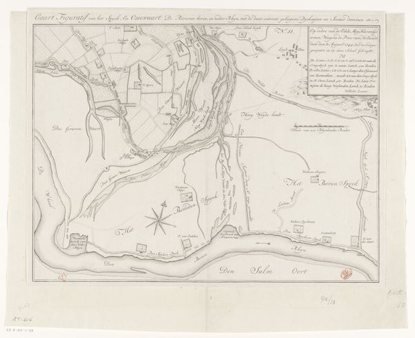
Dimensions: height 324 mm, width 710 mm
Copyright: Rijks Museum: Open Domain
Leonardus Schenk Jansz created this map of the Neder-Rijn and IJssel rivers with ink on paper. The lines of the waterways dominate, curving across the landscape, suggesting both movement and containment. The eye is drawn to the contrast between the open, unmarked spaces and the dense, framed texts that offer explanation and context. The map operates as a semiotic system, where each line, symbol, and textual block carries specific information. The river's curves aren't merely aesthetic but functional, conveying navigational possibilities and territorial boundaries. The detailed annotations challenge any fixed interpretation, highlighting the dynamic interaction between the viewer and the visual field. Consider how the cartographer uses space to communicate not just geographic data but also systems of power and knowledge. This map invites us to question how we perceive and categorize space, revealing the layered meanings embedded in what might initially seem like a straightforward representation.
Comments
No comments
Be the first to comment and join the conversation on the ultimate creative platform.
More like this