graphic-art, print, engraving
#
graphic-art
#
baroque
# print
#
old engraving style
#
cityscape
#
engraving
Dimensions: height 198 mm, width 250 mm
Copyright: Rijks Museum: Open Domain
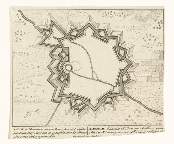
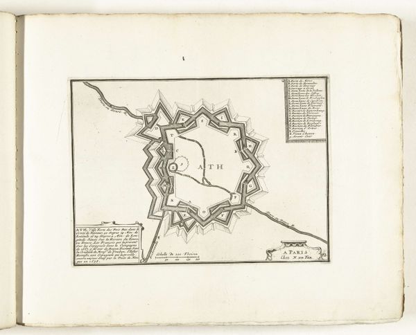
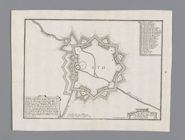
Harmanus van Loon produced this etching, Vestingplattegrond van Aat, or Fortress Map of Ath, around 1687. It's an intriguing image that reveals the priorities of its time: military strategy and territorial control. Made in the Dutch Republic during a period of intense geopolitical maneuvering in Europe, the map offers insight into the ongoing conflicts between European powers. The elaborate fortifications surrounding the city highlight the importance of strategic positioning and defense during this era of frequent warfare. We can even see evidence of Vauban's influence on the city's design following its capture by the French in 1667. The map served not just as a navigational tool, but also as a symbol of power, demonstrating the control and authority wielded by those who possessed this knowledge. Analyzing such a map involves delving into military history, engineering, and politics. By doing so, we can understand how social, economic, and political forces shape our ways of seeing.
Comments
No comments
Be the first to comment and join the conversation on the ultimate creative platform.
More like this