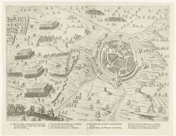
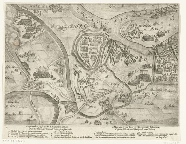
Kaart van Sluis, het Zwin en de schansen aan beide zijden, 1627 1627
0:00
0:00
claesjanszvisscher
Rijksmuseum
drawing, print, ink, engraving
#
drawing
#
dutch-golden-age
# print
#
landscape
#
ink
#
cityscape
#
engraving
Dimensions: height 365 mm, width 454 mm
Copyright: Rijks Museum: Open Domain
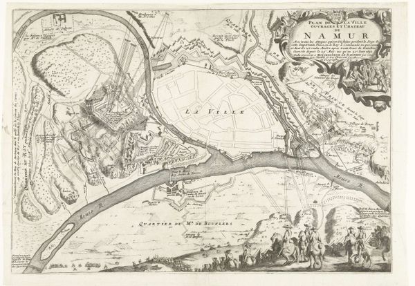
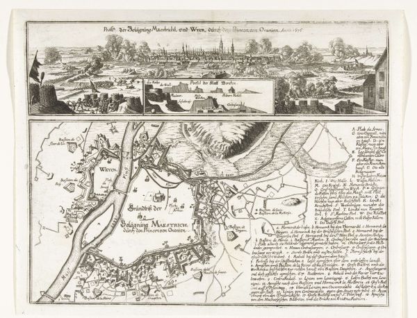
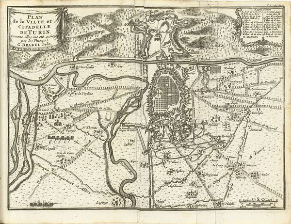
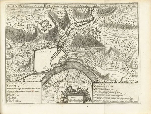
Claes Jansz. Visscher made this map of Sluis, the Zwin, and the fortifications on both sides in 1627, using etching. It offers a fascinating insight into the social and political landscape of the Dutch Republic during the early modern period. The map depicts a strategically important region, marked by waterways and fortifications. Its visual codes and cultural references tell a story of territorial control, trade, and military defense. Made during the Dutch Golden Age, this map reflects the economic and political power of the Netherlands, particularly its dominance in maritime trade. The detailed depiction of fortifications speaks to the ongoing conflicts and power struggles of the time, with the Dutch Republic vying for control against Spanish and other European powers. This map's existence, preserved in the Rijksmuseum, highlights how institutions shape our understanding of history. To truly understand this map, a historian would delve into archives, examining trade records, military strategies, and political treaties. The meaning of art, as this map demonstrates, is always contingent on its social and institutional context.
Comments
No comments
Be the first to comment and join the conversation on the ultimate creative platform.
More like this