About this artwork
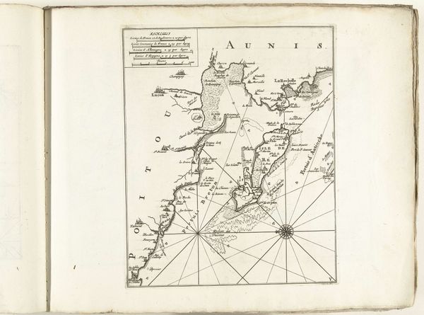
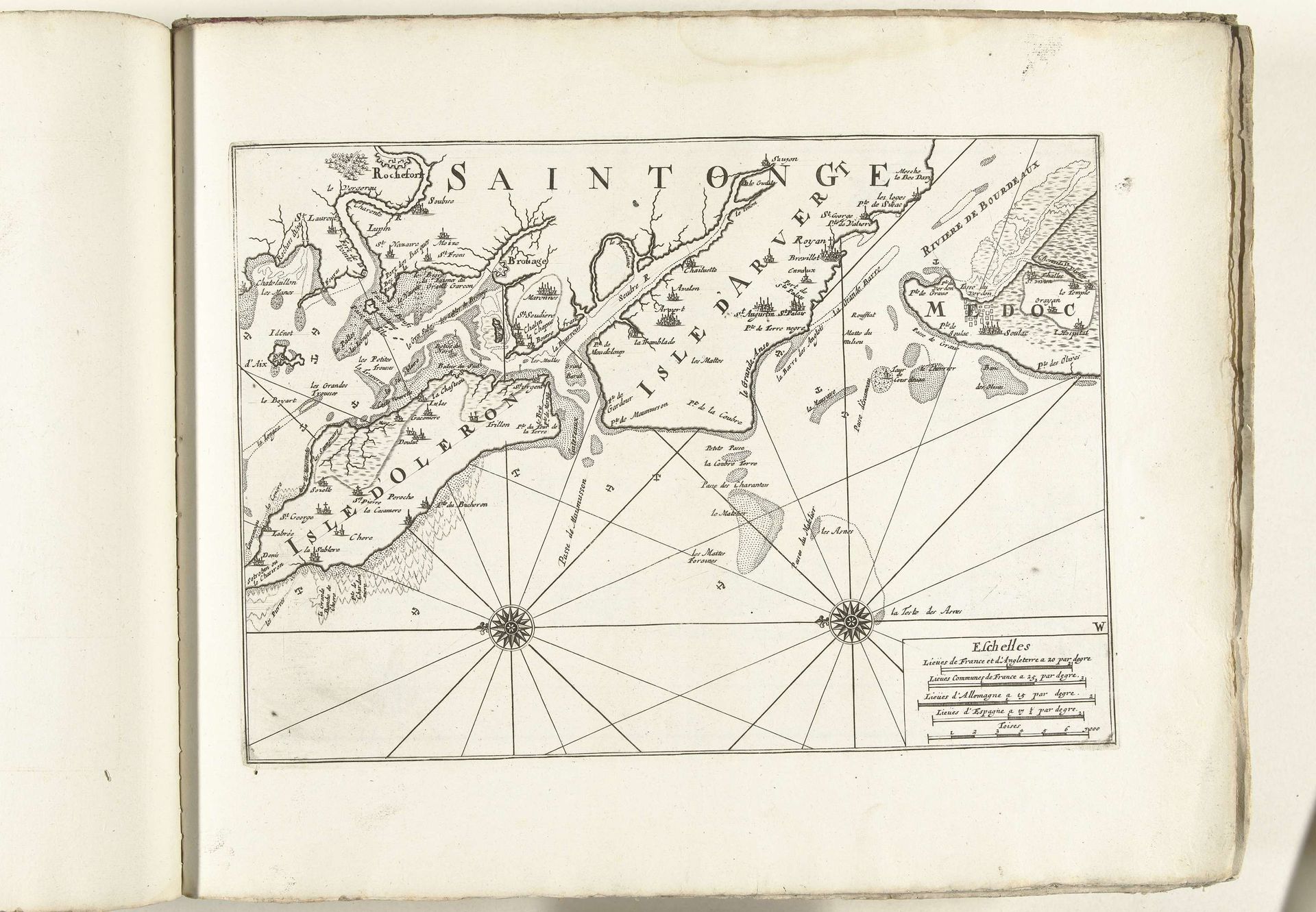
This is an anonymous map of the French west coast near Rochefort, made around 1702. The cartographer presents us with a landscape dominated by interconnected waterways. The winding rivers and coastlines are rendered with precise, delicate lines, creating an intricate network across the paper. The composition is structured by the radiating lines from two compass roses, which not only serve a navigational purpose but also visually organize the space. The detailed rendering of the land and sea suggests an effort to capture and control the geographical space through representation. Each stroke and carefully placed label becomes a signifier, encoding geographical and political information. The map’s formal qualities, its lines and structures, invite us to consider the broader cultural and philosophical implications of mapping as an act of constructing knowledge and power. The map is not merely a reflection of reality but an interpretation, imbued with the values and intentions of its creator and the society for which it was made.
Kaart van de Franse westkust bij Rochefort, ca. 1702
1702 - 1703
Anonymous
@anonymousLocation
RijksmuseumArtwork details
- Medium
- print, engraving
- Dimensions
- height 236 mm, width 333 mm
- Location
- Rijksmuseum
- Copyright
- Rijks Museum: Open Domain
Tags
Comments
Share your thoughts
About this artwork
This is an anonymous map of the French west coast near Rochefort, made around 1702. The cartographer presents us with a landscape dominated by interconnected waterways. The winding rivers and coastlines are rendered with precise, delicate lines, creating an intricate network across the paper. The composition is structured by the radiating lines from two compass roses, which not only serve a navigational purpose but also visually organize the space. The detailed rendering of the land and sea suggests an effort to capture and control the geographical space through representation. Each stroke and carefully placed label becomes a signifier, encoding geographical and political information. The map’s formal qualities, its lines and structures, invite us to consider the broader cultural and philosophical implications of mapping as an act of constructing knowledge and power. The map is not merely a reflection of reality but an interpretation, imbued with the values and intentions of its creator and the society for which it was made.
Comments
Share your thoughts