1641
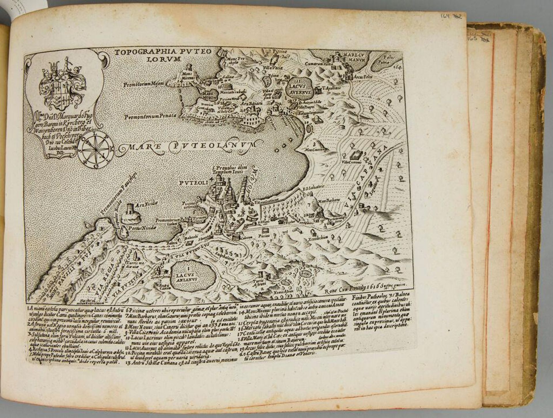
Map of Puteoli
Listen to curator's interpretation
Curatorial notes
Curator: Take a look at Giacomo Lauro's "Map of Puteoli," a fascinating copperplate engraving now housed at the Harvard Art Museums. Editor: What strikes me first is how alive it feels! It's not just lines on paper, it almost breathes with the rhythm of the coast. Curator: Lauro was meticulous in documenting the topography. Notice the detailed rendering of the town, the fortifications, the waterways... each element speaks to Puteoli's importance as a port city. It served as a vital point for trade and military access. Editor: The compass rose is a nice touch. I like how the mapmaker acknowledges that these towns and ports serve as a point of orientation for travelers and explorers. Curator: Absolutely, and the inclusion of the coat of arms emphasizes civic pride and control over resources. It also underscores the social hierarchy involved in the production and consumption of such a map. Editor: Looking at this, you begin to appreciate the role that a town had in offering people a sense of identity. Thanks for pointing that out. Curator: My pleasure. It really shows the intersection of commerce, power, and artistic production. Editor: And, of course, how even a "technical" drawing like this can reveal so much about the cultural landscape.