drawing, print, ink, engraving
#
drawing
#
baroque
#
pen drawing
# print
#
ink
#
geometric
#
cityscape
#
engraving
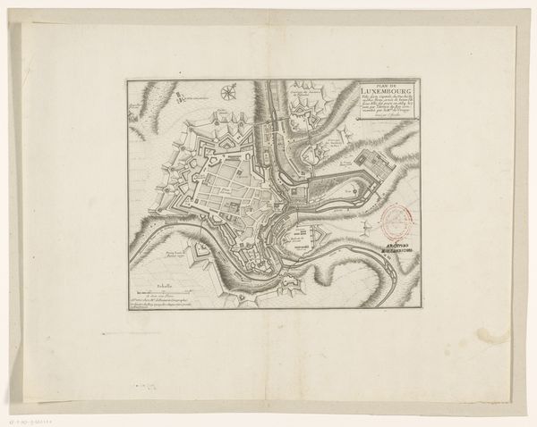
Dimensions: height 211 mm, width 275 mm
Copyright: Rijks Museum: Open Domain
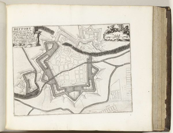
This anonymous plan of Luxembourg, created around 1693 to 1696, is rendered in ink, where lines define the architecture and landscape. The texture created by the fine, dense linework provides a certain depth and visual interest to the two-dimensional map. Notice how the geometric forms of the city’s fortifications contrast with the organic shapes of the surrounding terrain. This tension between the man-made and the natural world speaks to the efforts to impose order on the landscape, reflecting early modern ideas about controlling space through reason and engineering. The map can be interpreted as a series of signs and symbols, each representing a specific aspect of the city. These carefully rendered lines and shapes can be understood as a discourse on power, reflecting how cartography was used to assert control over territory and resources. The plan invites us to consider the relationship between representation and reality, and to contemplate how maps are not neutral documents but cultural artifacts that shape our understanding of the world.
Comments
No comments
Be the first to comment and join the conversation on the ultimate creative platform.
More like this