1721 - 1725
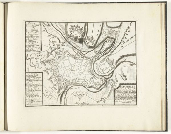
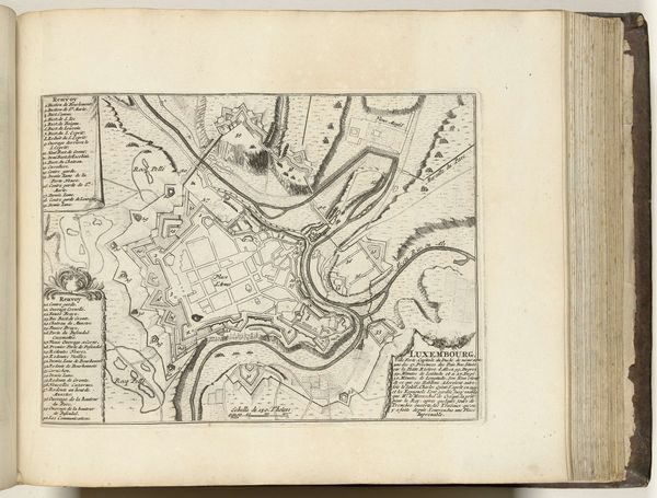
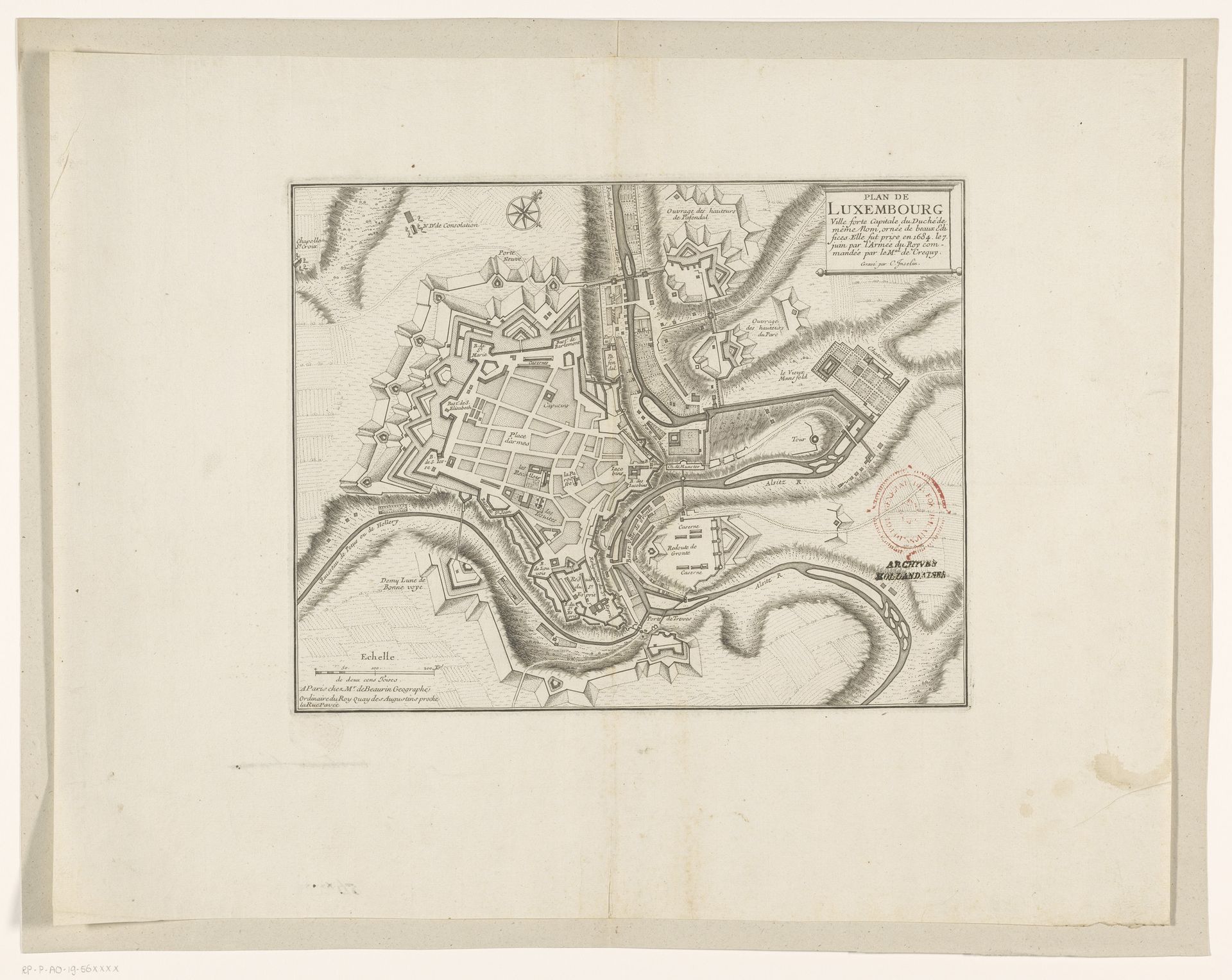
Vestingplattegrond van Luxemburg
Listen to curator's interpretation
Curatorial notes
Charles Inselin created this "Vestingplattegrond van Luxemburg" print. The artwork presents a meticulous layout with sharp lines and a balanced composition, where architectural and geographical features intersect. The shades of grey convey a sense of depth and strategic military planning. Considered through a structuralist lens, the city map is more than just a representation of space. It functions as a semiotic system in which walls, roads, and fortifications act as signs. These denote power, control, and the structuring of society. The precision of the lines and the detailed rendering invite us to decode not just the physical layout but also the ideologies embedded within the urban planning. The map challenges any singular interpretation, instead it opens up multiple layers of meaning. We can see both a functional design for military defense and a symbolic representation of social order. It encourages us to interpret the city as a text, with each element contributing to a larger narrative of governance.