print, etching, engraving
#
narrative-art
#
dutch-golden-age
# print
#
etching
#
landscape
#
etching
#
geometric
#
cityscape
#
engraving
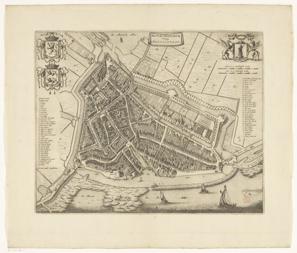
Dimensions: height 342 mm, width 509 mm
Copyright: Rijks Museum: Open Domain
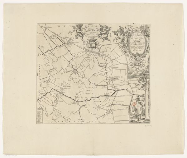
Curator: Let's turn our attention to this fascinating map: *Kaart van de grietenij Gaasterland*. Dating from between 1698 and 1718, it's an etching and engraving. Editor: Wow, my first thought is... such dedication! All those tiny, precise lines. It feels almost meditative to look at. Like a really complex, historic coloring book page. Curator: Precisely. These maps weren't just navigational tools; they were statements of power, displays of meticulous craftsmanship, of course requiring collaboration among surveyors, engravers, and publishers. We have to appreciate this not only as art but as a complex commodity. The paper itself, its source, tells part of the story. Editor: You know, thinking of the labor… all those artisans bent over their work, the scratch of the etching needle. There's a whole symphony of making embedded in this image, and each decision reflects their expertise, the very essence of their being is permanently embedded into the artwork itself! Do you think they ever got sick of drawing those tiny little houses? Curator: Well, considering the context – the Dutch Golden Age – these prints served a vital role. The Dutch Republic was a burgeoning commercial power. Mapping wasn't just about geography; it was about controlling trade routes, asserting territorial claims, and visually codifying social space and the systems of governance that it depends upon. Editor: Absolutely! And that cartouche at the top, it’s more than just decoration, right? With the figures, almost allegorical? Curator: Exactly! The decorative elements would be crucial for signifying patronage, geographic specificities, and more; we see visual claims that function not only on the landscape of Gaasterland, but also perform within the map's reception and economy of circulation in 17th and 18th century Dutch print markets. Editor: So it’s like reading a little play within the map. Curator: Exactly. We can delve into its social life too: who bought these maps, how they were used, what spaces did they circulate within? This helps us to historicize a seemingly straightforward artifact, drawing into view the network of power that this represents and the lives it touches. Editor: It really makes you appreciate the layered meaning. The simple appreciation I had at first – I have such a deeper one now. It really humanizes the labor in my eyes and reminds me the human touch! Curator: Yes! From commodity to context! I found myself gaining a better sense of Gaasterland, which now, for me, bears so many faces of human effort and political symbolism.
Comments
No comments
Be the first to comment and join the conversation on the ultimate creative platform.
More like this