drawing, print, paper, ink, engraving
drawing
baroque
pen illustration
landscape
paper
ink
geometric
cityscape
engraving
Dimensions: height 184 mm, width 275 mm
Copyright: Rijks Museum: Open Domain
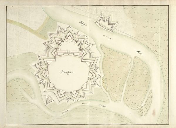
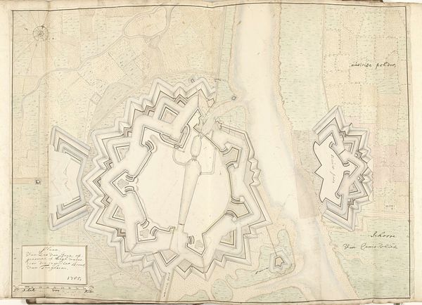
This is Abraham Allard’s “Plattegrond van Fort Louis,” a detailed engraving made in the Netherlands, probably around the turn of the 18th century. It’s a bird’s-eye view of a star-shaped fortress, built by Louis XIV on an island in the Rhine, near Strasbourg. What are we to make of this image? Well, on the one hand, it’s a technical drawing that depicts a military structure, while on the other, it showcases the power of the French monarchy. The image creates meaning through visual codes: the fortress itself, with its geometric precision, tells of the military engineering of the era. It’s self-consciously modern. But it also speaks to the tensions between France and its neighbors in the Alsace region, as France sought to expand its territory. Understanding this map means delving into the history of 17th and 18th century European power politics, understanding the military strategies of Louis XIV, and knowing the history of cartography. The meaning of art is always contingent on its social and institutional context.
Comments
No comments
Be the first to comment and join the conversation on the ultimate creative platform.