Possibly 1531 - 1889
Orontius Finaeus
Listen to curator's interpretation
Curatorial notes
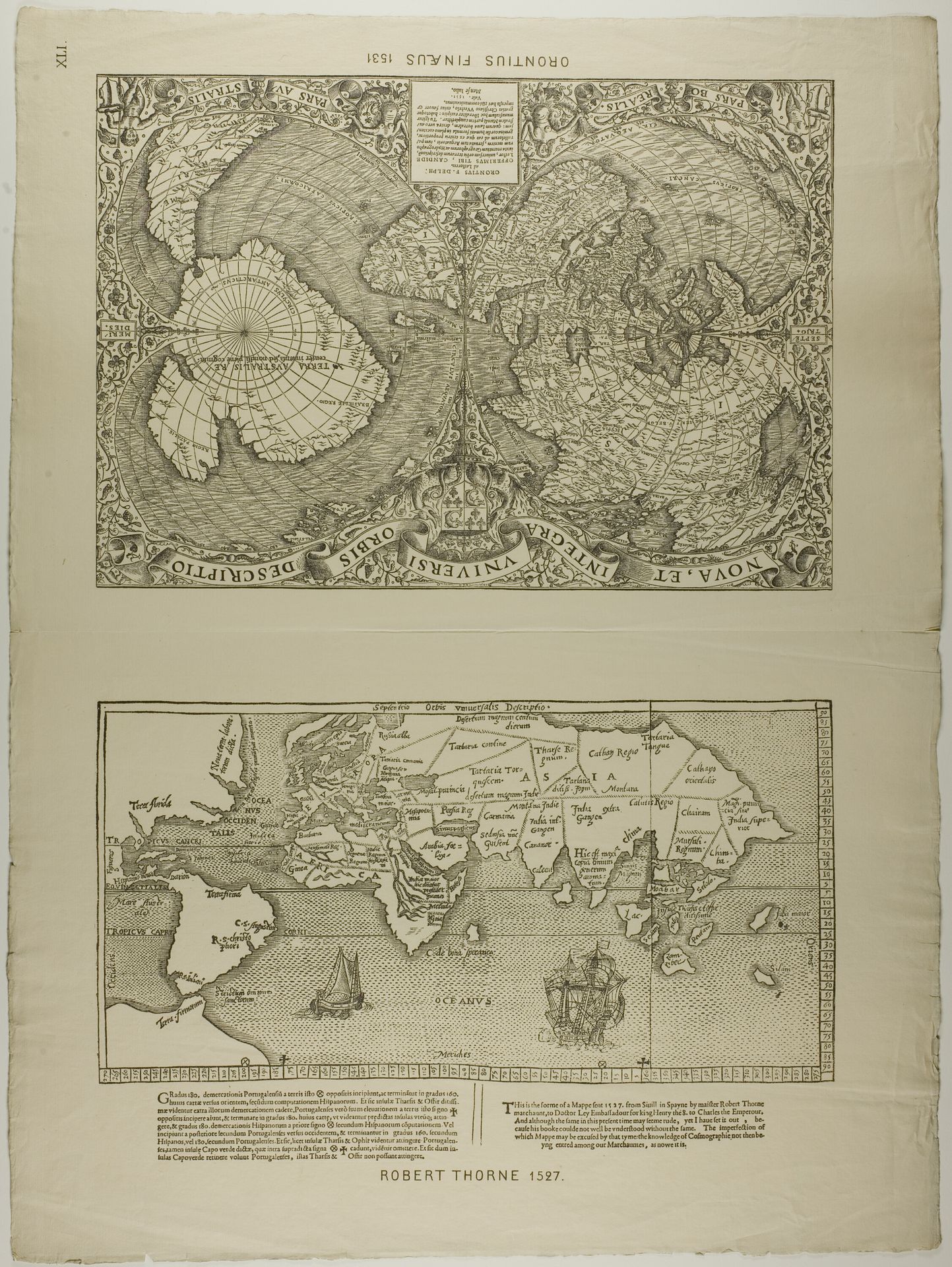
Robert Thorne created this map entitled "Orontius Finaeus" in 1527. Composed of detailed engravings, the map presents an early modern vision of global geography, emphasizing both known and speculative lands. The map is divided into two sections, each revealing a distinct perspective on the world. Above, the Northern and Southern Hemispheres are displayed, characterized by radial lines and meticulous details suggesting cartographic precision, though much of it remains theoretical. Below, a rectangular map offers a closer view of recognizable continents, such as Africa and South America, albeit with noticeable distortions. Thorne’s work underscores the period's fascination with exploration and the attempt to structure a comprehensive understanding of the world. The map's form, while attempting scientific accuracy, inevitably reflects the conceptual frameworks and limitations of its time, serving as a potent reminder of how knowledge itself is structured through representation.