drawing, print, paper, ink, engraving
drawing
aged paper
toned paper
baroque
pen sketch
old engraving style
paper
personal sketchbook
ink
pen-ink sketch
pen work
sketchbook drawing
cityscape
watercolour illustration
sketchbook art
engraving
Dimensions: height 226 mm, width 291 mm
Copyright: Rijks Museum: Open Domain
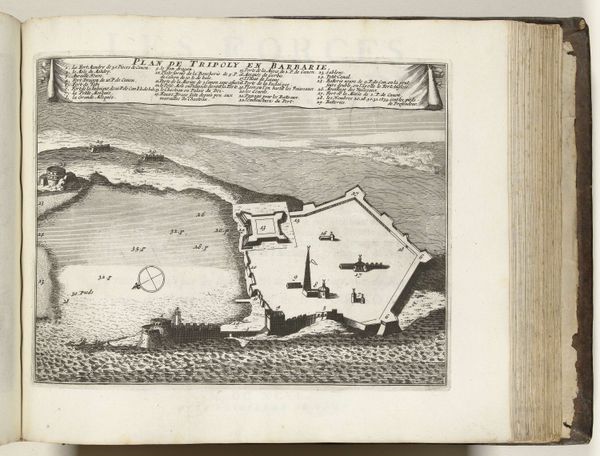
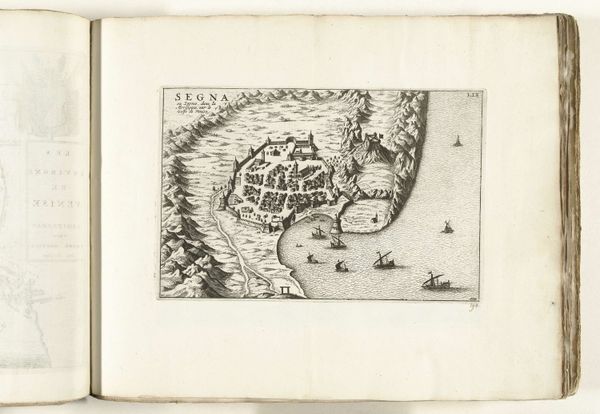
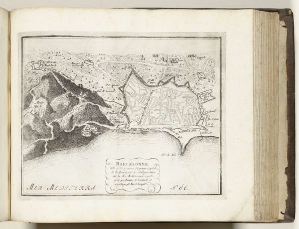
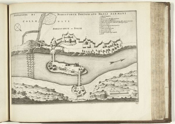
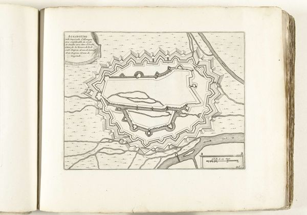
Curator: Looking at this detailed rendering of Tripoli dating back to 1726, my immediate thought turns to the paper. How was it made? Was it imported, or locally produced? And the ink, its specific chemical makeup likely has stories to tell about trade routes and available resources. Editor: Absolutely. Beyond the sheer physicality, there's such a compelling colonial narrative at play. A map like this wasn’t simply an innocent document, it was a tool—a visual instrument for domination and control over both territory and its inhabitants. Who commissioned it, and what purpose did it truly serve? Curator: I find it fascinating to examine the production itself; the etching lines, seemingly precise, betray the hand of the artist and, indeed, the limits of contemporary cartography. How does the artisanship shape our understanding of this city? Editor: The act of mapping inherently involves choices: what to include, what to omit, what to emphasize. Notice how prominent the fortifications are represented compared to other parts of the cityscape. That sends a potent message about power and priorities during this period, in which trade depended so heavily on controlled sea lanes. Curator: You're drawing my attention to how military might might have literally shaped this community’s development! In considering that impact, though, what local methods of crafting, building, or trade may have helped strengthen those systems? The material and labor involved often reflect existing infrastructures that precede colonizing powers. Editor: That’s precisely it. Looking beyond the imposing facade, we have to wonder whose stories were suppressed in this supposedly objective rendering of a place. Whose labor was exploited in constructing those very fortifications? And how did the local population perceive this cartographic intrusion upon their land and lives? This isn’t just a map; it's a frozen moment of socio-political theater. Curator: It almost reads like propaganda from a safe distance—a means of portraying Tripoli, both as a tangible resource but also an exploitable source for production. These types of historical artworks serve as evidence not only of skill and craftsmanship but an invitation to study and critique globalized hierarchies of resources. Editor: And hopefully an urgent call to keep mapping new futures from perspectives that have too often been marginalized from historical narratives.
Comments
No comments
Be the first to comment and join the conversation on the ultimate creative platform.