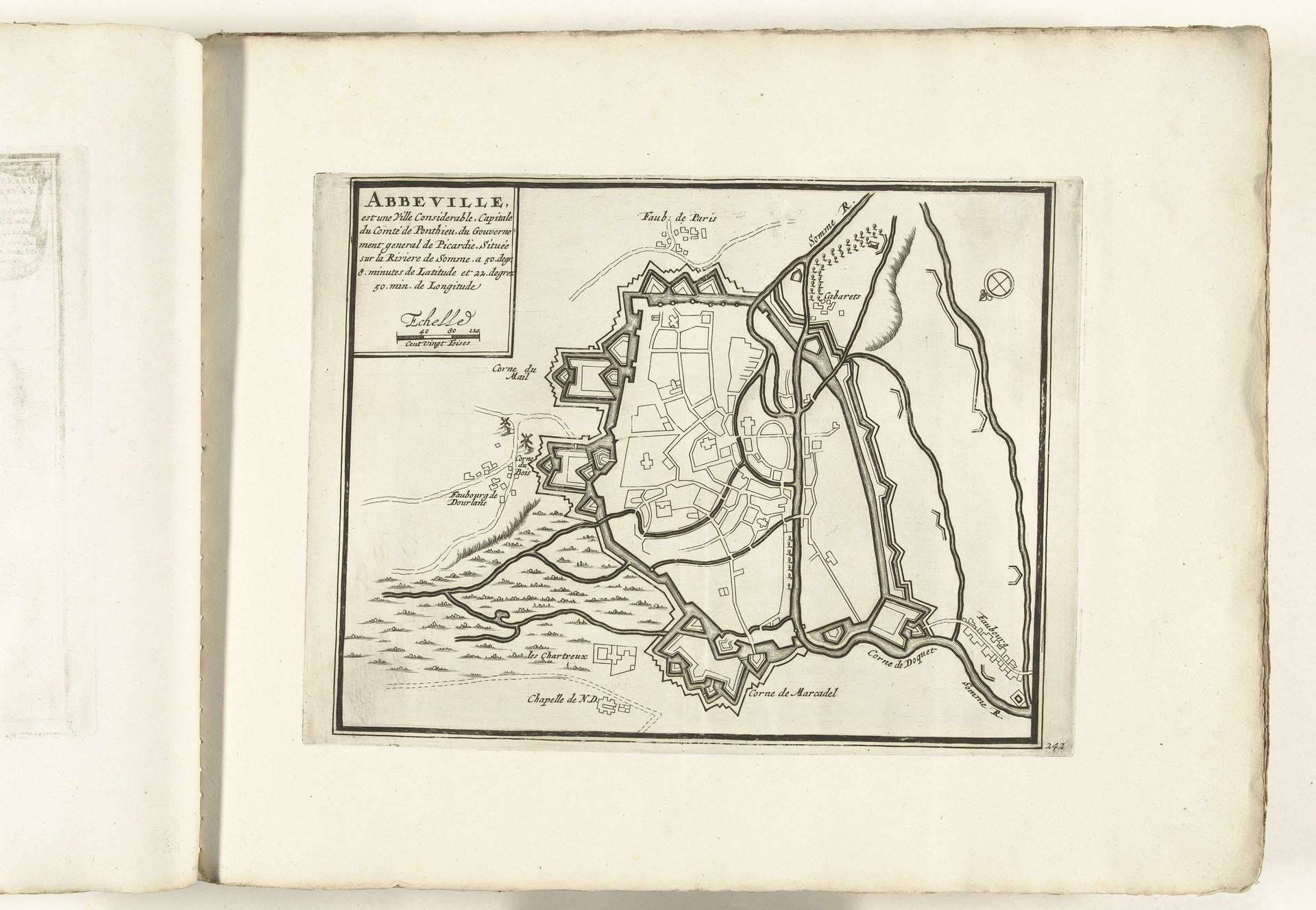
1702 - 1703
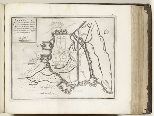
Plattegrond van Abbeville, ca. 1702
Anonymous
@anonymousLocation
RijksmuseumListen to curator's interpretation
Curatorial notes
Editor: So this is "Plattegrond van Abbeville," a cityscape made around 1702 by an anonymous artist. It’s a drawing and print with ink and engraving on paper, held at the Rijksmuseum. It has such detailed lines, and somehow makes me think of city planning and fortifications, what stands out to you? Curator: I'm interested in how this plan of Abbeville, rendered with such precision through drawing and engraving, becomes an object in itself. Consider the labor involved in its production, from the surveying and initial sketches to the meticulous work of the engraver. These aren’t just lines on paper. Editor: So, it's the work and materials used that really tell the story? Curator: Precisely! Think about the social context too. Who commissioned this map? What purpose did it serve? Was it for military planning, civic administration, or perhaps even propaganda? Maps like these were instruments of power. Editor: That makes a lot of sense, I guess it served a very practical use and could influence someone. What is your takeaway from all this? Curator: This print invites us to consider the relationships between labor, power, and representation, challenging us to look beyond the surface and examine the material conditions of its creation. Editor: Thank you for your insight; I didn't realize the historical purpose it served when thinking about "material".