drawing, print, paper, ink, engraving
#
drawing
#
baroque
# print
#
paper
#
ink
#
geometric
#
cityscape
#
history-painting
#
engraving
Dimensions: height 228 mm, width 288 mm
Copyright: Rijks Museum: Open Domain
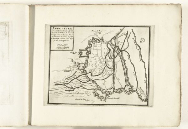
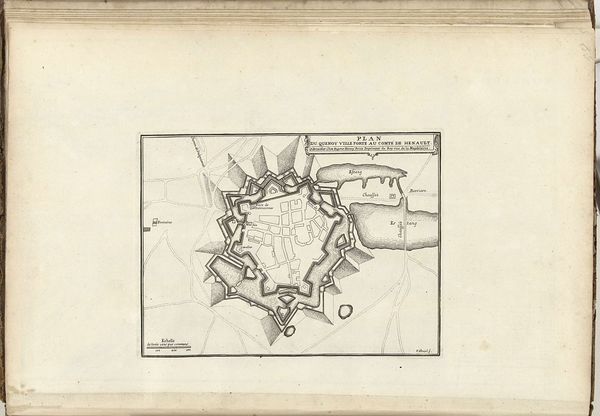
This is an anonymous map of Abbeville from around 1693 to 1696, rendered in ink. The stark monochrome palette emphasizes the geometrical precision of its lines. The city's layout, viewed from above, is circumscribed by angular fortifications and sinuous waterways. This structured composition reflects a period where urban planning was dictated by military strategy, with the angles of the fort designed to mitigate external threats. The clean lines suggest an interest in legibility, but more than just a functional document, the map also reveals a mindset rooted in rationalism. The stark contrast between the structured man-made elements and the more organic natural elements invites contemplation on the interplay between human will and the natural world. Observe how the map reduces complex space into a set of signs. The artist presents a world mediated through representation, inviting the viewer to consider the semiotic systems through which we understand and control our environment.
Comments
No comments
Be the first to comment and join the conversation on the ultimate creative platform.
More like this