About this artwork
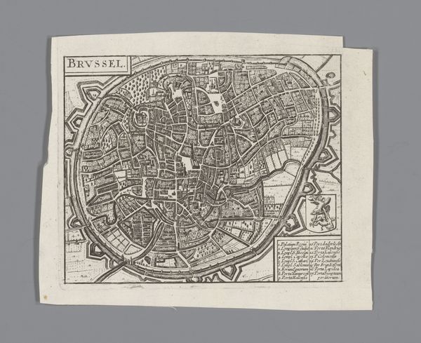
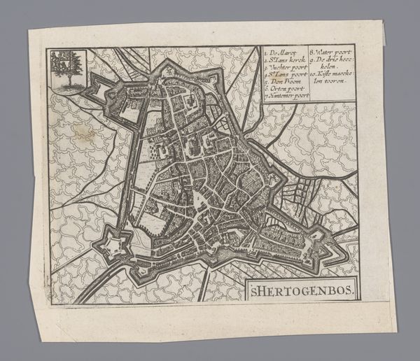
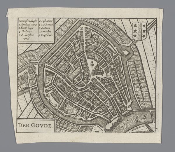
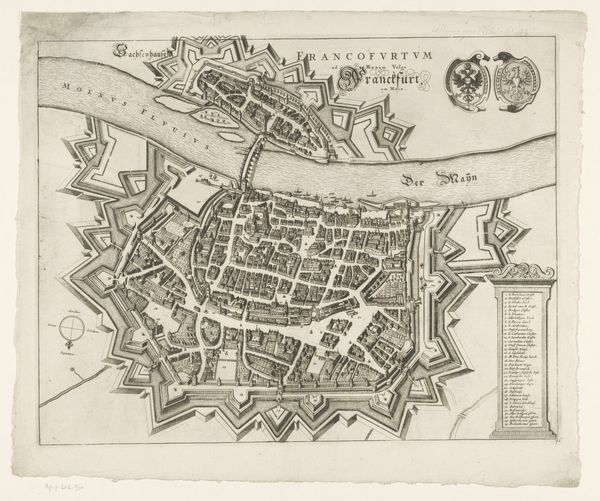
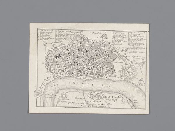
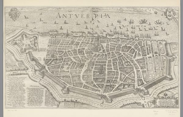
This is an anonymous map of Antwerp, rendered with ink on paper. Its creation and reception were deeply influenced by the political and economic tensions of its time. Antwerp, as a major port city, was a melting pot of cultures and commerce, yet also a site of conflict during the religious and political upheavals of the 16th and 17th centuries. The map is not just a depiction of urban space, but also a representation of power and control. The city's fortifications and strategic layout reflect the ever-present threat of invasion and siege. Moreover, the map tells a story of social stratification, where the wealthy merchants and ruling elite occupied the city's center, while the working class and marginalized communities were relegated to the periphery. The emotional weight of this division is palpable, as the map becomes a stark reminder of the disparities that shaped the lives of Antwerp's inhabitants. While the map adheres to traditional cartographic conventions, it also hints at alternative narratives of resilience and resistance.
Artwork details
- Medium
- print, paper, engraving
- Dimensions
- height 160 mm, width 141 mm
- Location
- Rijksmuseum
- Copyright
- Rijks Museum: Open Domain
Tags
Comments
Share your thoughts
About this artwork
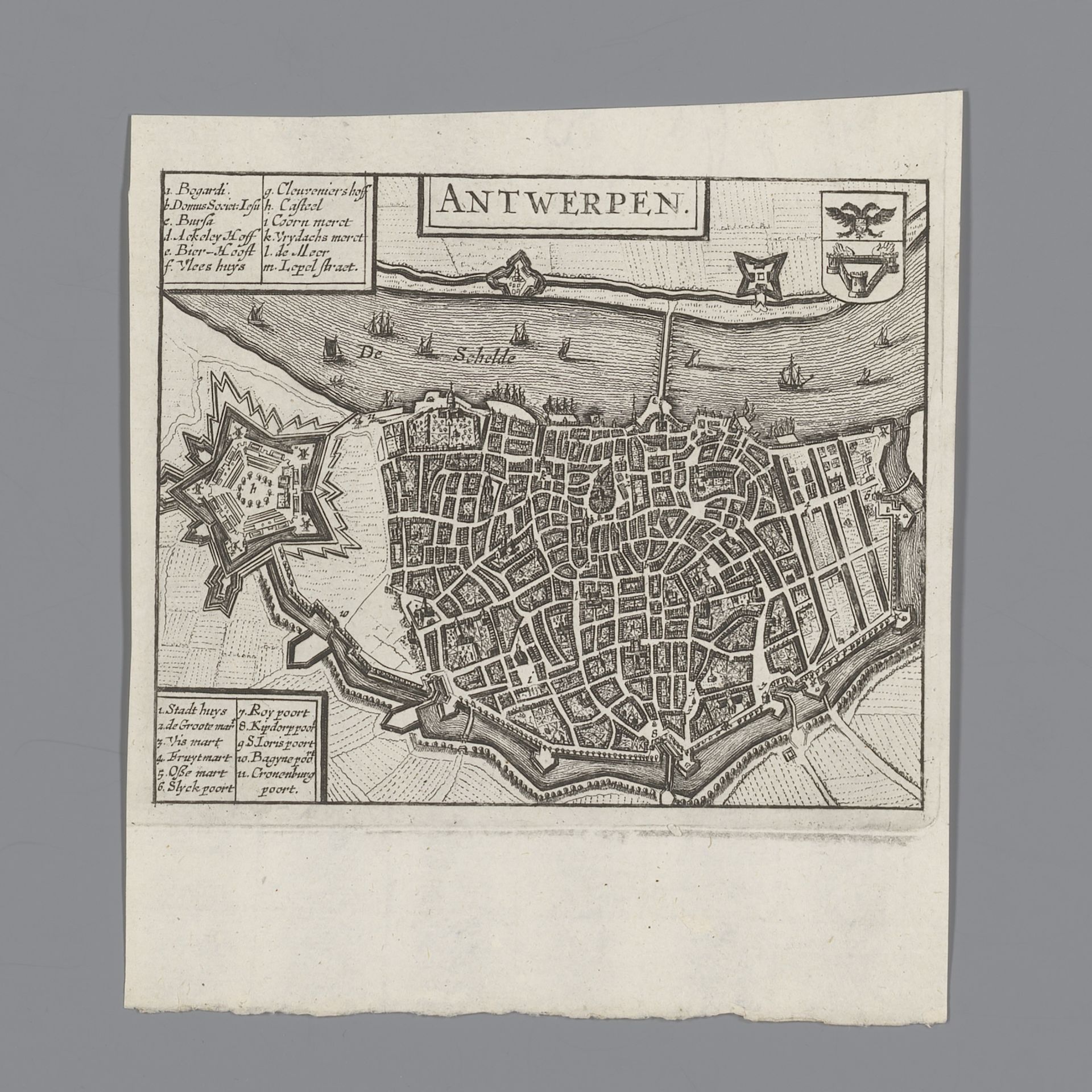
This is an anonymous map of Antwerp, rendered with ink on paper. Its creation and reception were deeply influenced by the political and economic tensions of its time. Antwerp, as a major port city, was a melting pot of cultures and commerce, yet also a site of conflict during the religious and political upheavals of the 16th and 17th centuries. The map is not just a depiction of urban space, but also a representation of power and control. The city's fortifications and strategic layout reflect the ever-present threat of invasion and siege. Moreover, the map tells a story of social stratification, where the wealthy merchants and ruling elite occupied the city's center, while the working class and marginalized communities were relegated to the periphery. The emotional weight of this division is palpable, as the map becomes a stark reminder of the disparities that shaped the lives of Antwerp's inhabitants. While the map adheres to traditional cartographic conventions, it also hints at alternative narratives of resilience and resistance.
Comments
Share your thoughts