About this artwork
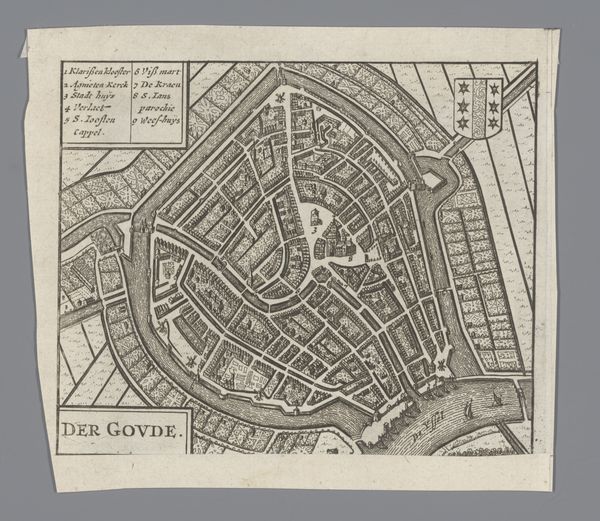
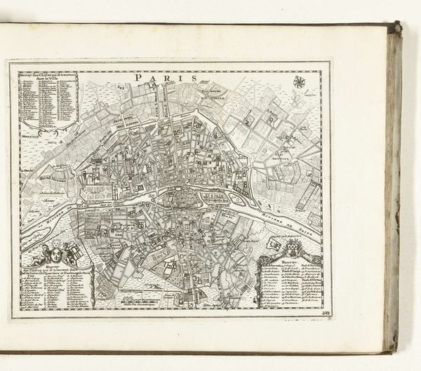
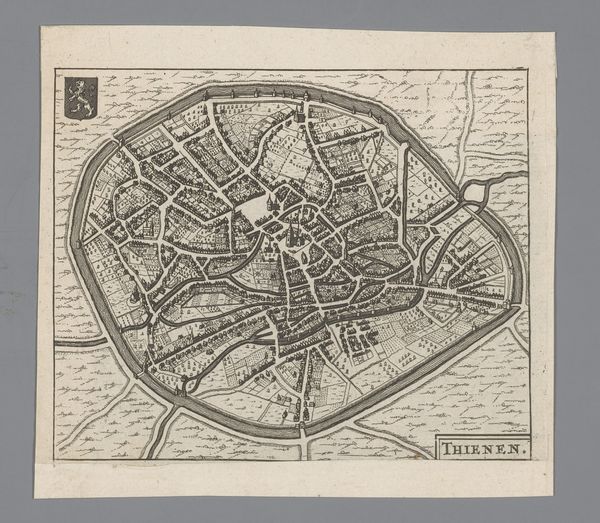
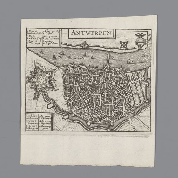
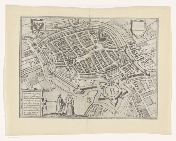
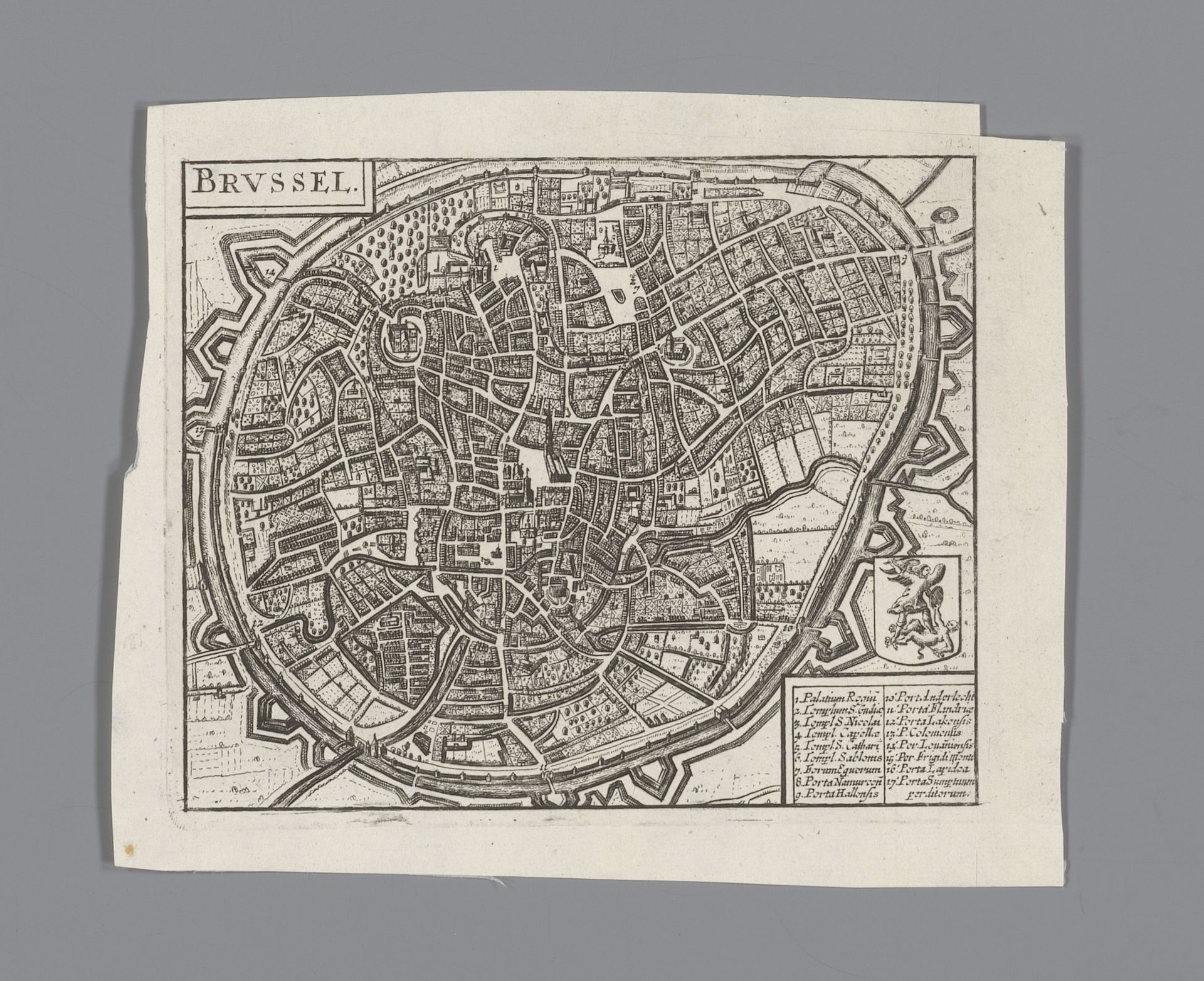
This is an anonymous engraving, “Plattegrond van Brussel” or Map of Brussels. The most striking aspect is the formal structure, organized within a fortified, oval boundary. The composition is a dense network of lines, forming streets and buildings. The sharp contrast between the dark lines and the white paper creates a high level of detail. Structurally, the map embodies a semiotic system, reducing urban space to a series of signs. The lines and shapes are not merely representations but function as a language, a coded way of communicating the city's organization. This abstraction challenges the viewer to decode Brussels’ urban structure. The map presents the city not as it is experienced, but as an ordered, knowable entity. This reflects a broader cultural interest in classifying and understanding the world through symbolic systems. Note how the formal qualities serve to transform the chaotic reality of a city into an exercise in symbolic order. The visual impact invites us to consider how maps create and shape our understanding of space.
Artwork details
- Medium
- print, engraving
- Dimensions
- height 131 mm, width 158 mm
- Location
- Rijksmuseum
- Copyright
- Rijks Museum: Open Domain
Tags
Comments
Share your thoughts
About this artwork
This is an anonymous engraving, “Plattegrond van Brussel” or Map of Brussels. The most striking aspect is the formal structure, organized within a fortified, oval boundary. The composition is a dense network of lines, forming streets and buildings. The sharp contrast between the dark lines and the white paper creates a high level of detail. Structurally, the map embodies a semiotic system, reducing urban space to a series of signs. The lines and shapes are not merely representations but function as a language, a coded way of communicating the city's organization. This abstraction challenges the viewer to decode Brussels’ urban structure. The map presents the city not as it is experienced, but as an ordered, knowable entity. This reflects a broader cultural interest in classifying and understanding the world through symbolic systems. Note how the formal qualities serve to transform the chaotic reality of a city into an exercise in symbolic order. The visual impact invites us to consider how maps create and shape our understanding of space.
Comments
Share your thoughts