after 1743
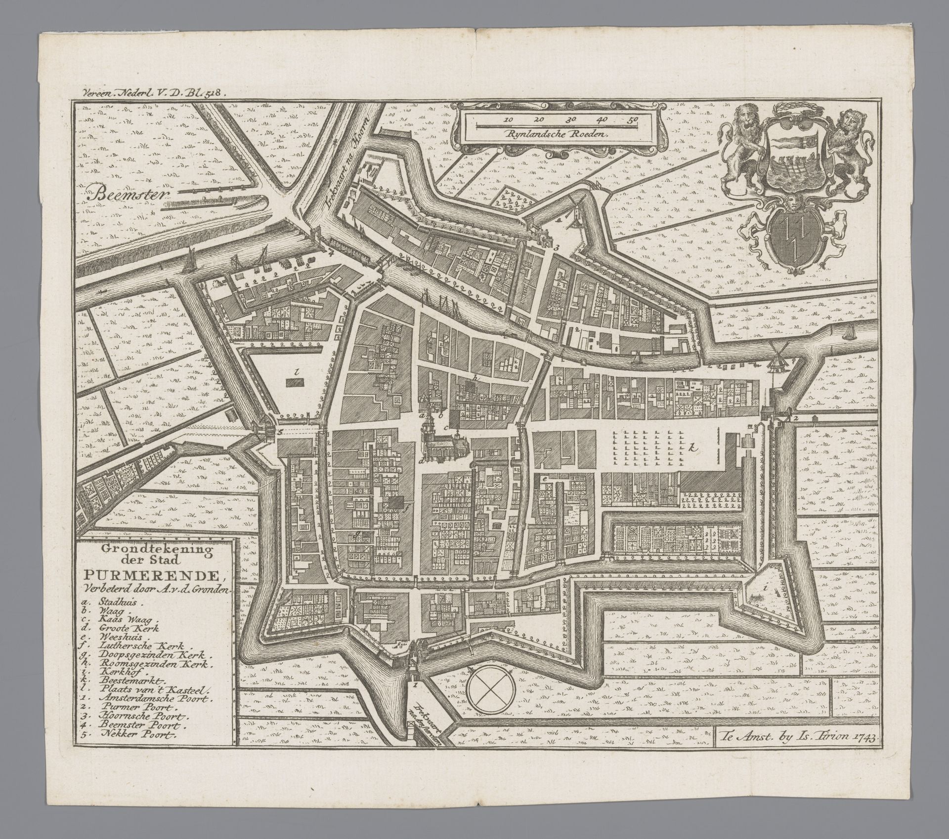
Plattegrond van Purmerend
Anonymous
@anonymousLocation
RijksmuseumListen to curator's interpretation
Curatorial notes
This map of Purmerend was made in 1743 by an anonymous artist, using the technique of engraving. Engraving is an intaglio process. A design is cut into a flat surface – typically a metal plate – with a tool called a burin. Ink is then applied to the surface and wiped away, remaining only in the incised lines, and the image is transferred to paper under high pressure in a printing press. Look closely, and you can see the crisp, precise lines achieved through this laborious process. Each mark demanded careful attention, reflecting not only the engraver's skill but also the urban planner's vision. The texture of the print, the weight of the paper, and the very act of reproduction all contribute to the map's social and cultural significance. It speaks to the aspirations of a society mapping its world, one line at a time. This map reminds us that even seemingly straightforward images are imbued with the labor and intentions of their makers, blurring the boundaries between art, craft, and the world around us.