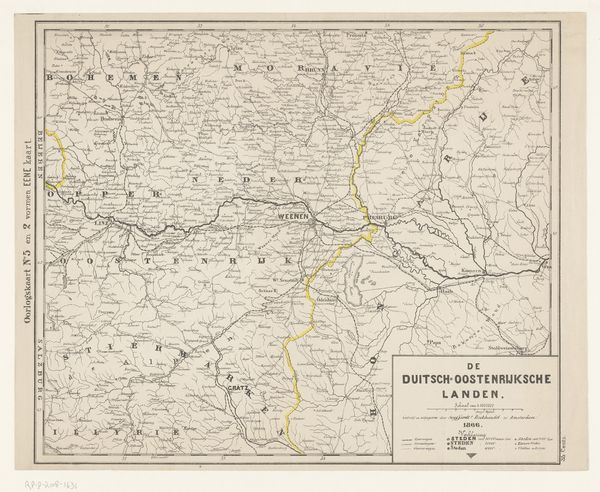
print, engraving
# print
#
old engraving style
#
geometric
#
history-painting
#
engraving
Dimensions: height 379 mm, width 556 mm
Copyright: Rijks Museum: Open Domain
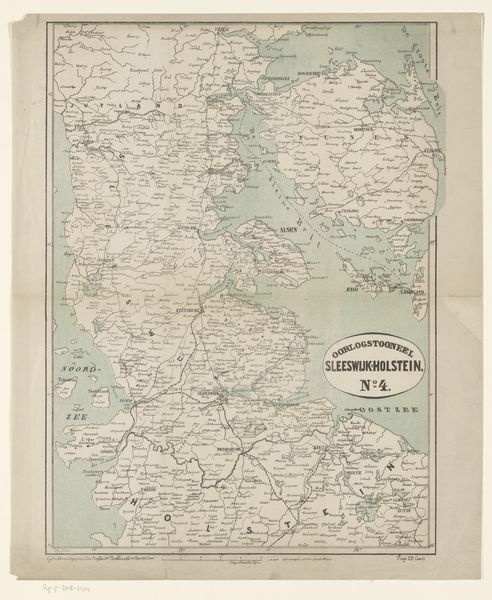
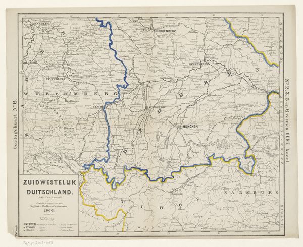
Curator: Good morning. We’re looking at "Kaart van het strijdtoneel in Silezië, Bohemen en Saksen, 1866," a print by Carl Friedrich Baur created between 1866 and 1867. Editor: My first impression is that it evokes a strong sense of control and order, perhaps even a kind of sterile dominance. The network of lines and shapes appears so precise and deliberate. Curator: Absolutely. The rigorousness speaks to the very language of cartography. Consider how Baur, through the incising lines of the engraving, meticulously transforms terrain into quantifiable space, abstracting the physical world into a structured, legible format. The engraving process itself lends a particular coolness and mechanical objectivity. Editor: Precisely. And that's where I find myself pondering the materiality of this print. The paper itself, probably mass-produced, the ink, the press, the skilled labor required for its crafting and distribution. It would have been part of a larger informational infrastructure for managing territory, resources, perhaps even troop movement. Curator: Yes, a powerful convergence of semiotics and pragmatism. Observe how elements—lines indicating borders, symbols representing cities and topographical features—work within a system, shaping the understanding of space, power, and authority of that era. Each component communicates volumes about geopolitical conditions and strategic imperatives. Editor: The question is: to whom does it give this power? Its physical creation demands resources, knowledge, specific industrial technologies. How would that reflect or even reinforce the distribution of authority and influence in the context it was created in? Who had access to the printing presses, the raw materials, or the sophisticated training? Curator: You prompt intriguing questions about access. The stark rendering of this print amplifies the sense of calculated strategy and control it served to facilitate. The print itself as an agent of something larger... Editor: Exactly. The physical presence of this map is itself part of the history, inseparable from those dynamics of control and the political circumstances it depicts. Curator: Thank you; the tactile and mechanical elements you spotlighted help unlock an expansive reading beyond lines on a page. Editor: It’s in those textures and social contexts, those seemingly small details, that the fuller narrative of art—and history—really materializes.
Comments
No comments
Be the first to comment and join the conversation on the ultimate creative platform.
More like this