About this artwork
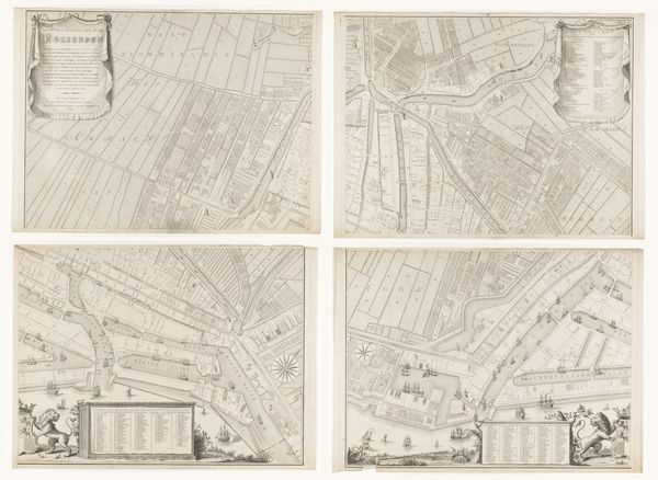
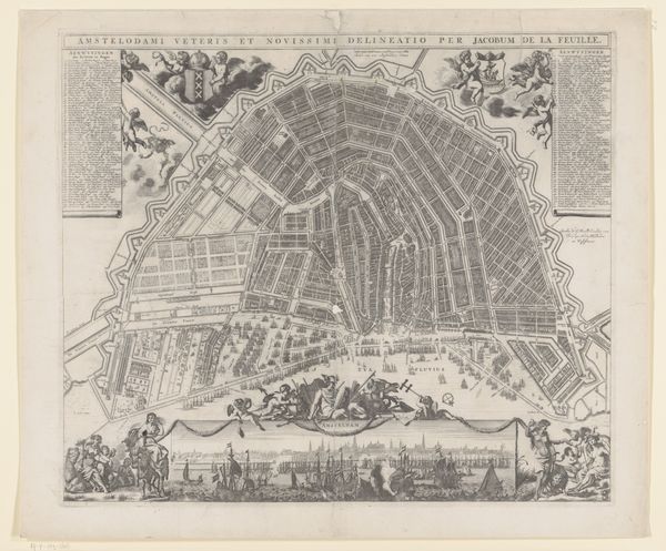
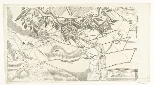
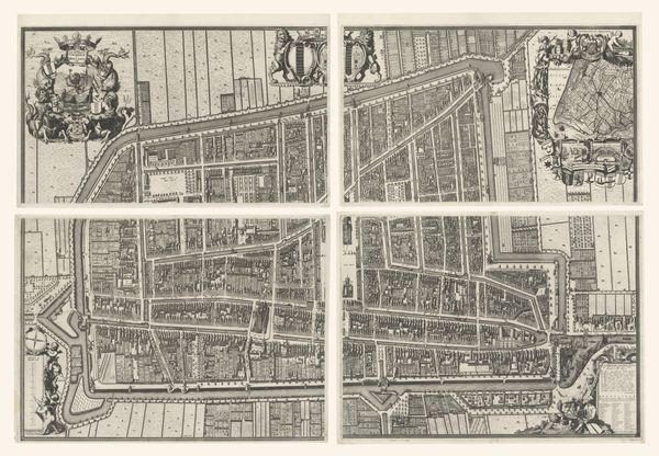
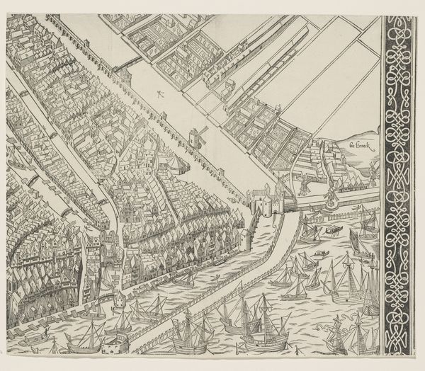
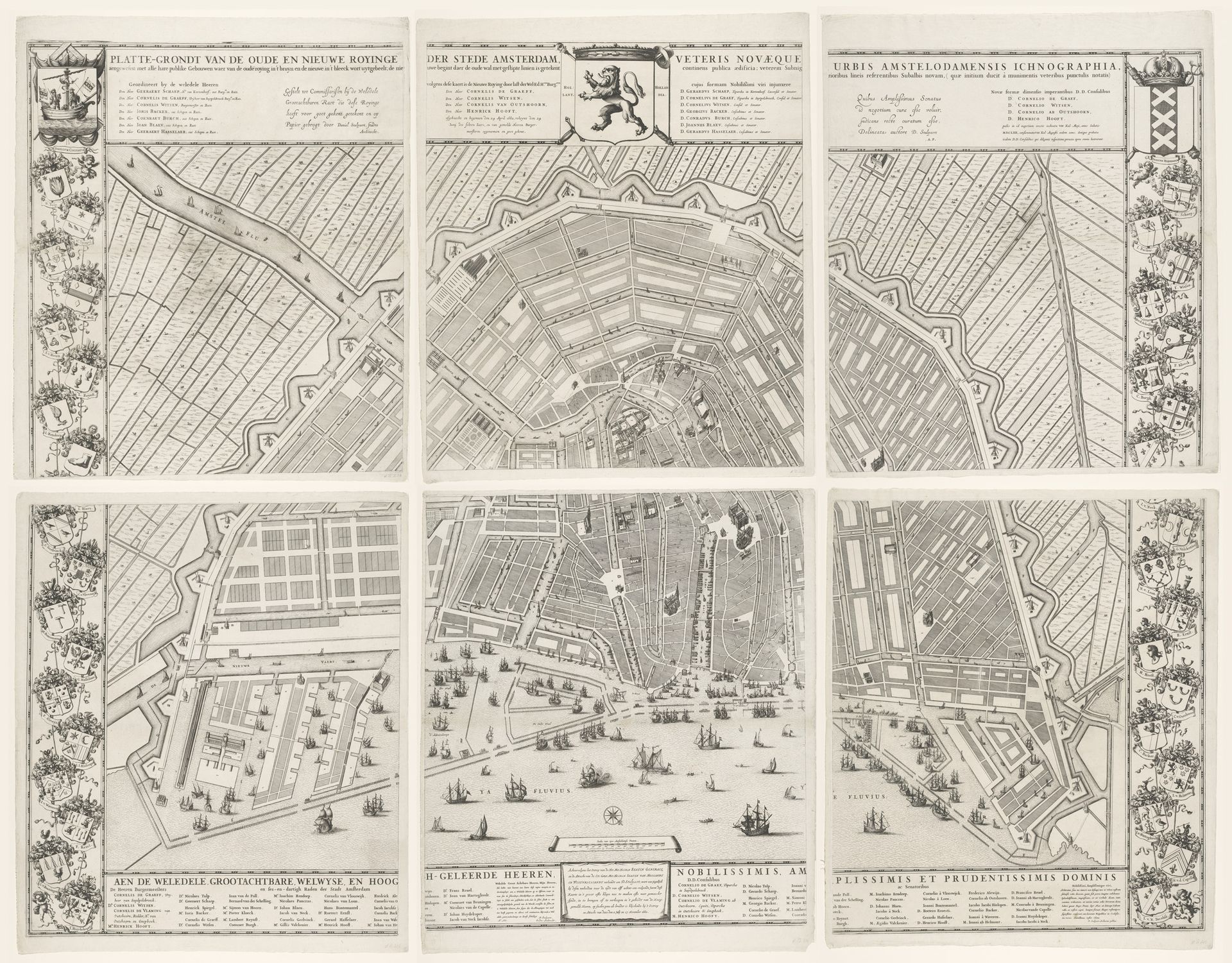
This is Julius Mülhüssen’s printed map of Amsterdam, showing the proposal for the city’s Fourth Expansion. What’s striking about this image is the explicit intersection of aesthetics, politics and economics. Maps aren’t neutral records of geographical space. Mülhüssen’s is a projection of power and control. The geometrical regularity of canals and building plots speaks to the Dutch Republic’s ambition to master and manipulate its environment for commercial gain. Made in the mid-17th century, it reflects Amsterdam’s golden age – a period of unprecedented economic growth fueled by maritime trade and colonial expansion. The map doesn't just represent a city; it embodies a worldview, one where human ingenuity and mercantile activity could reshape the world. Historians use maps like these, alongside other archival sources, to understand how urban spaces are not just built, but imagined, negotiated, and contested. The map invites us to reflect on the power dynamics embedded in the urban landscape.
Plattegrond van Amsterdam met ontwerp en uitvoering van de Vierde Uitleg, bestaande uit zes delen
Possibly 1663 - 1774
Artwork details
- Medium
- graphic-art, print, etching, engraving
- Dimensions
- height 1246 mm, width 1615 mm
- Copyright
- Rijks Museum: Open Domain
Tags
Comments
Share your thoughts
About this artwork
This is Julius Mülhüssen’s printed map of Amsterdam, showing the proposal for the city’s Fourth Expansion. What’s striking about this image is the explicit intersection of aesthetics, politics and economics. Maps aren’t neutral records of geographical space. Mülhüssen’s is a projection of power and control. The geometrical regularity of canals and building plots speaks to the Dutch Republic’s ambition to master and manipulate its environment for commercial gain. Made in the mid-17th century, it reflects Amsterdam’s golden age – a period of unprecedented economic growth fueled by maritime trade and colonial expansion. The map doesn't just represent a city; it embodies a worldview, one where human ingenuity and mercantile activity could reshape the world. Historians use maps like these, alongside other archival sources, to understand how urban spaces are not just built, but imagined, negotiated, and contested. The map invites us to reflect on the power dynamics embedded in the urban landscape.
Comments
Share your thoughts