About this artwork
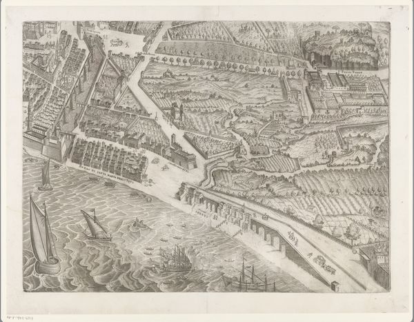
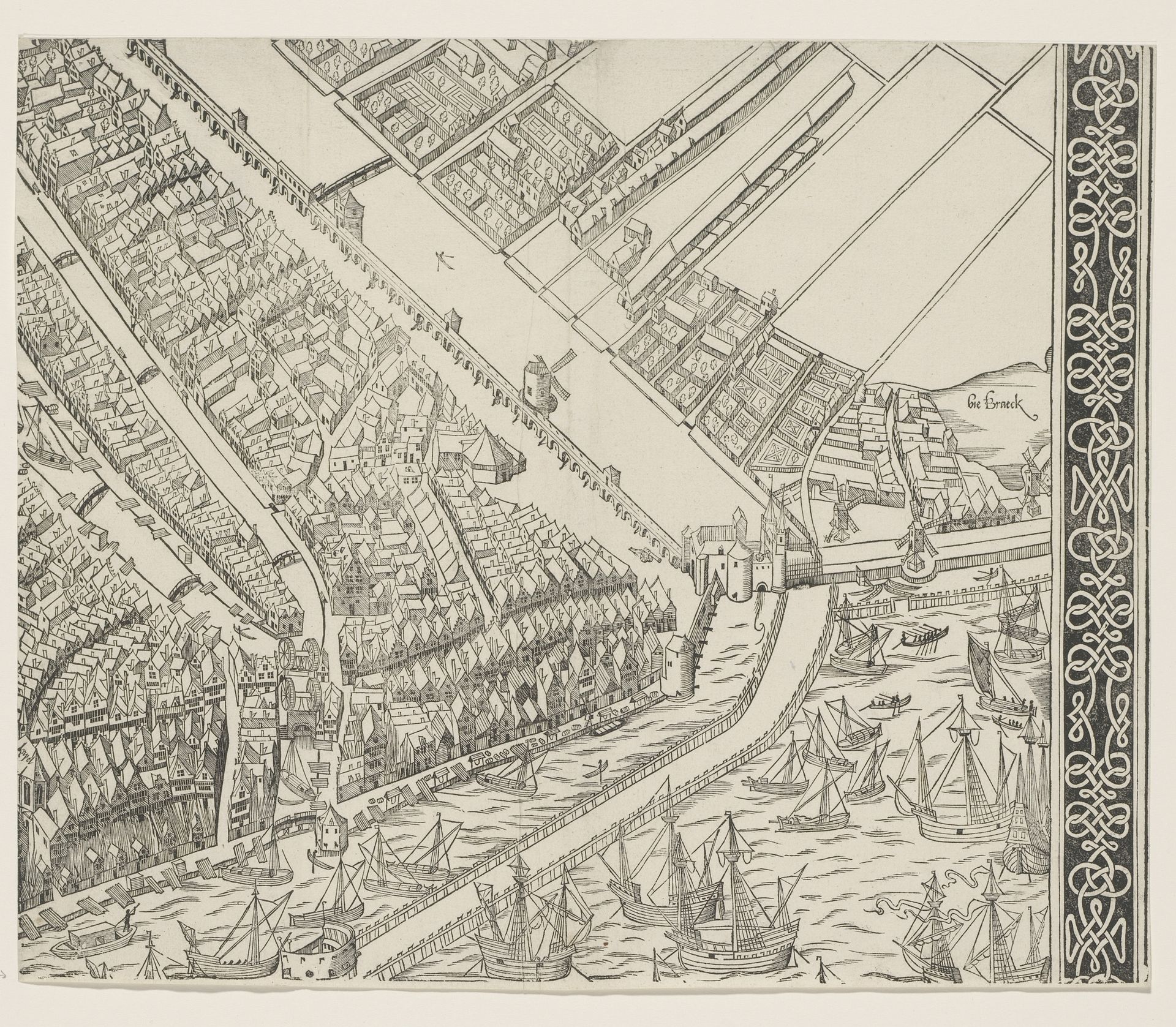
Cornelis Anthonisz. created this map of Amsterdam in 1544. The image offers us more than just a layout of the city. It invites us to reflect on Amsterdam’s identity as a burgeoning center of trade and culture during the early modern period. Notice the ships docked along the waterfront, symbols of Amsterdam’s maritime power and its central role in international commerce. This map was made during a time of religious and social upheaval, as the Protestant Reformation challenged existing power structures. Anthonisz., as a local artist, would have been deeply embedded in the social fabric of Amsterdam. His map doesn’t just show streets and buildings; it tells a story about the city's ambitions. Maps like these were crucial tools for governance, trade, and asserting control over territory. Consider how maps shape our understanding of place and belonging. What stories do they tell, and whose perspectives do they include or exclude?
Plattegrond van Amsterdam, 1544 (negende deel)
c. 1544 - 1557
Cornelis Anthonisz.
1499 - 1553Location
RijksmuseumArtwork details
- Medium
- drawing, print, ink, engraving
- Dimensions
- height 295 mm, width 356 mm
- Location
- Rijksmuseum
- Copyright
- Rijks Museum: Open Domain
Tags
Comments
Share your thoughts
About this artwork
Cornelis Anthonisz. created this map of Amsterdam in 1544. The image offers us more than just a layout of the city. It invites us to reflect on Amsterdam’s identity as a burgeoning center of trade and culture during the early modern period. Notice the ships docked along the waterfront, symbols of Amsterdam’s maritime power and its central role in international commerce. This map was made during a time of religious and social upheaval, as the Protestant Reformation challenged existing power structures. Anthonisz., as a local artist, would have been deeply embedded in the social fabric of Amsterdam. His map doesn’t just show streets and buildings; it tells a story about the city's ambitions. Maps like these were crucial tools for governance, trade, and asserting control over territory. Consider how maps shape our understanding of place and belonging. What stories do they tell, and whose perspectives do they include or exclude?
Comments
Share your thoughts