drawing, print, etching, engraving
#
drawing
#
baroque
# print
#
etching
#
etching
#
cityscape
#
engraving
Dimensions: height 483 mm, width 583 mm
Copyright: Rijks Museum: Open Domain
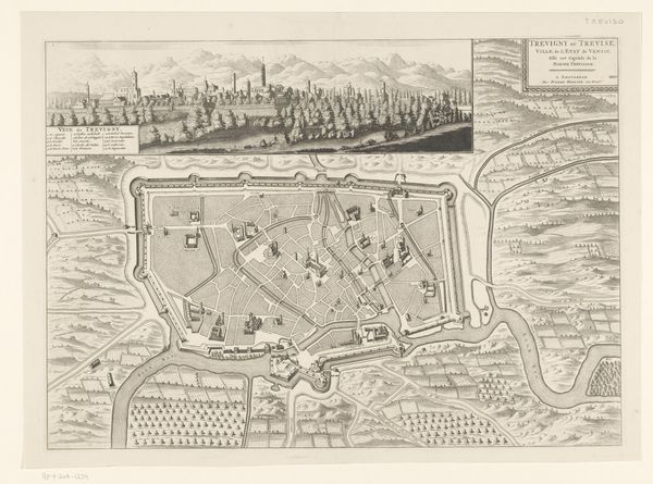
This is an anonymous engraving, showing a bird's-eye view of Brescia, which offers a glimpse into the intricacies of urban life and military strategy of the time. Created during an era of territorial disputes, this detailed map goes beyond mere geography; it is an assertion of power and control. The fortifications, city walls, and strategic placements of key buildings, reflect not only the city’s physical layout, but also the societal structures and power dynamics inherent in urban planning. Brescia, referred to as Bresse aux Venetiens, was located in a region of overlapping interests between Venice and other powers, highlighting the cultural and political tensions of the area. As you examine this plan, consider how the visual organization of space influences the lives of its inhabitants and reflects broader socio-political contexts. Consider the intersections of military strategy, urban development, and cultural identity, as illustrated through this detailed engraving.
Comments
No comments
Be the first to comment and join the conversation on the ultimate creative platform.
More like this