graphic-art, print, engraving
#
graphic-art
#
dutch-golden-age
# print
#
landscape
#
perspective
#
geometric
#
cityscape
#
engraving
Dimensions: height 583 mm, width 888 mm
Copyright: Rijks Museum: Open Domain
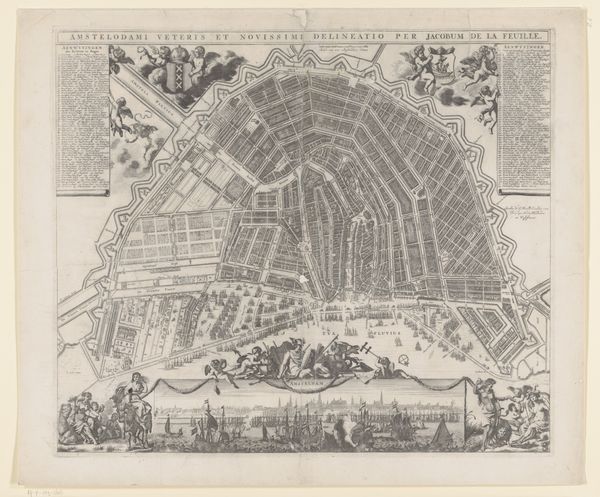
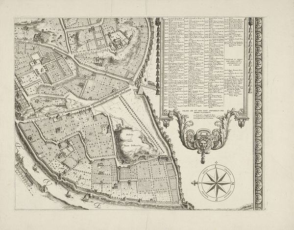
Hendrik de Leth created this map of Amsterdam in the 18th century, rendered with ink on paper. The intricate lines weave together, presenting a dense urban plan that invites the viewer into a careful study of its forms. De Leth’s composition balances utility with artistry, creating a detailed yet idealized representation of the city. The map is structured by a radial symmetry, which is disrupted by the irregular shapes of the waterways and fortifications. These elements introduce a level of complexity that complicates any easy reading of Amsterdam as a purely rational space. The use of line and shading not only defines the architectural layout but also suggests a semiotic reading of the city, where each structure and space carries meaning. The map functions both as a navigational tool and as a cultural artifact, reflecting Amsterdam’s self-image as a center of commerce and culture. The careful detail of the city's layout challenges our perception of urban spaces as fixed and knowable.
Comments
No comments
Be the first to comment and join the conversation on the ultimate creative platform.
More like this