print, engraving
#
dutch-golden-age
# print
#
geometric
#
cityscape
#
engraving
Dimensions: height 498 mm, width 582 mm
Copyright: Rijks Museum: Open Domain
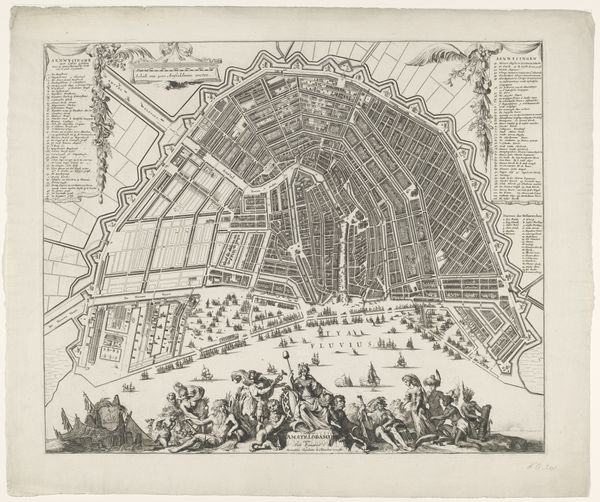
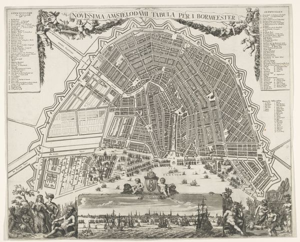
Johannes de Ram’s ‘Plattegrond van Amsterdam’, made with etching and engraving, presents a bird's-eye view of Amsterdam. The intricate linework maps out the city's complex network of canals and streets. The city's radial layout, with its concentric canals, is a testament to urban planning, designed for both aesthetic appeal and practical functionality. The map's visual structure isn't merely representational. The precise delineation of urban space reflects a broader cultural desire to impose order on the world. This impulse towards systematization mirrors contemporaneous philosophical concerns with rationality and empirical observation. The rigid geometry of the canals and blocks contrasts with the decorative elements, such as the cherubs and coats of arms, creating a dialogue between scientific accuracy and symbolic representation. Consider how the map’s formal organization and stylistic choices, such as the detailed street patterns, not only convey spatial information but also reflect the burgeoning sense of civic pride and order in 17th-century Amsterdam. The map invites us to consider how art intersects with cartography, philosophy, and urban planning.
Comments
No comments
Be the first to comment and join the conversation on the ultimate creative platform.
More like this