print, engraving
#
dutch-golden-age
# print
#
cityscape
#
engraving
Dimensions: height 125 mm, width 150 mm
Copyright: Rijks Museum: Open Domain
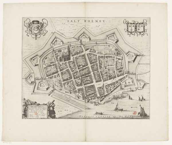
Here we see an anonymous plan of Dordrecht, created with etching, and now held at the Rijksmuseum. The stark contrast between the dark lines of the map and the light paper creates a visually striking image, emphasizing the intricate details of the city’s layout. The composition is dominated by the structured organization of the city itself, a network of geometric shapes defining buildings and streets within the circular form of the city's perimeter. The river and the arrangement of ships emphasize the city's relationship with trade. This structured representation can be interpreted through a semiotic lens, where each line and shape functions as a signifier of urban planning and social order. The map's scale, though small, manages to convey a sense of comprehensive detail. It is not just a geographical tool but a cultural document, reflecting the values and priorities of its time. The ordered layout and strategic placement of key buildings create a discourse around power, control, and knowledge, where the representation of space is also an assertion of authority.
Comments
No comments
Be the first to comment and join the conversation on the ultimate creative platform.
More like this