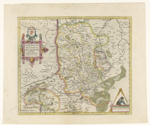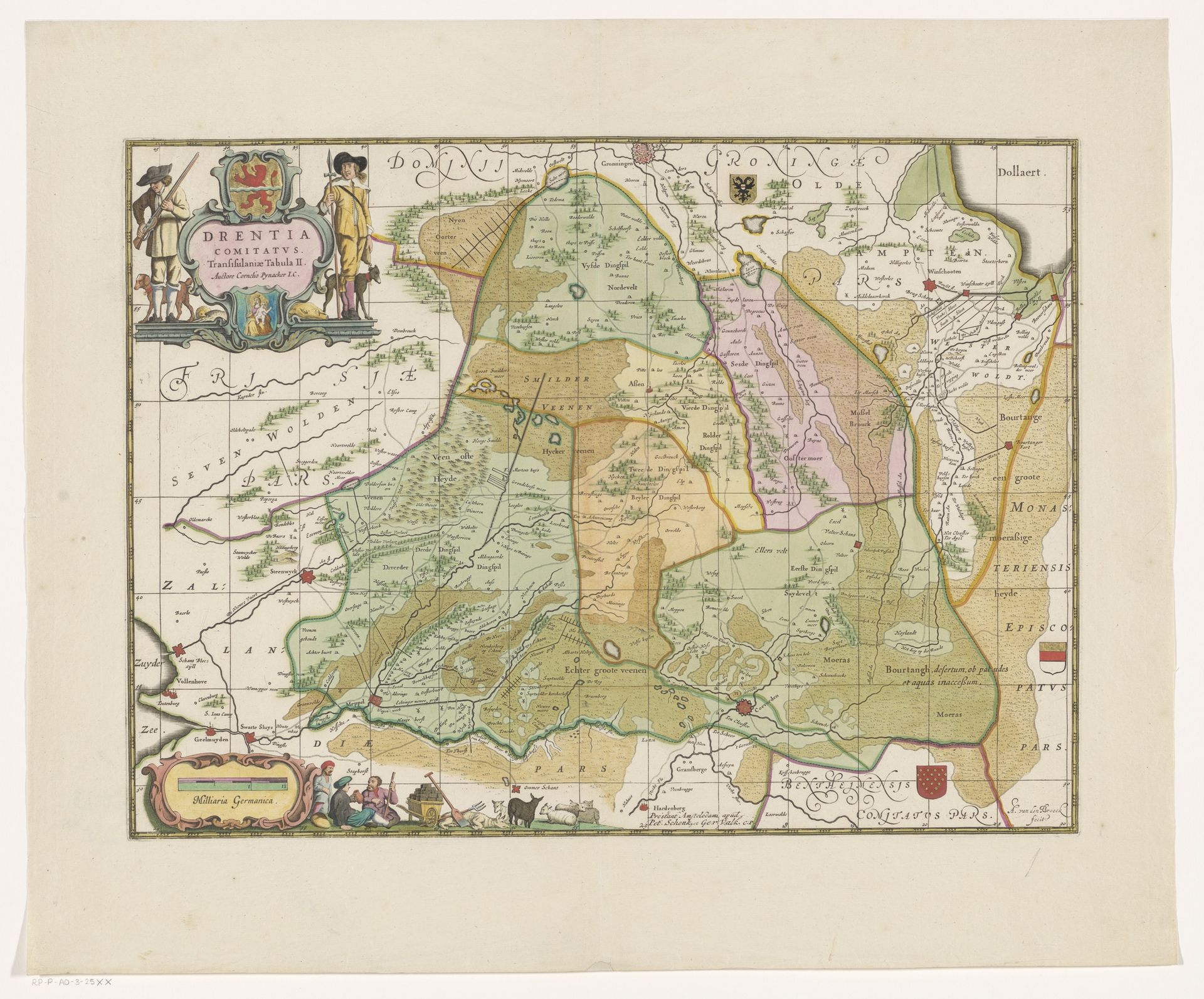
1638 - 1711
Kaart van Drenthe
Listen to curator's interpretation
Curatorial notes
Curator: Here we have "Kaart van Drenthe," a watercolor painting from between 1638 and 1711, attributed to Abraham van den Broeck. What's your initial impression? Editor: The muted colors create a very serene feel. There's a definite sense of order and precision in the rendering, yet something still quite naive about it as well. Curator: Absolutely. If we look closely at the pigments, especially in the washes of green and ochre that define the land, we can consider the readily available earth tones accessible during this period and what it meant to represent a territory through such materiality. Editor: From a compositional point of view, I am drawn to the contrasting geometric grids and the more organic shapes that outline geographical areas and topographic reliefs. It shows the way cartography straddles science and aesthetics. Curator: Consider, too, the rise of Dutch cartography in the 17th century. Maps weren’t just navigational tools; they were displays of power, investments, trade agreements, instruments of control and markers of emerging nations. Look at how this specific map details plots, cultivated lands and estates of a particular social stratum. Editor: The very act of charting territory inherently brings along a perspective on social hierarchies of ownership. You can find semiotic codes of who owned land and laborers who were put to work on these spaces. The landscape rendered in pigment represents not only physical terrain, but it becomes social strata. Curator: Indeed. The very paper and ink become political tools as landowners survey their domains and claim legitimacy through mapping exercises and representational depictions. Even the choice of watercolor speaks volumes. The pigments available tell stories of global trade and accessibility and also how far power extended over natural resources. Editor: Reflecting upon this, it makes me ponder the idea of boundaries – are they ever just lines? Here, this rendering suggests power embedded in its cartographic representation. The boundaries that seemed purely representational are instead complex manifestations. Curator: It brings to light how the art of the Dutch Golden Age, even seemingly neutral maps, were so closely entwined with commercial interests and expressions of status, power, and even political expansionism. Editor: Thank you; thinking through material realities certainly deepens our perspective.