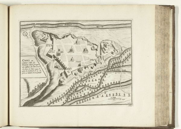
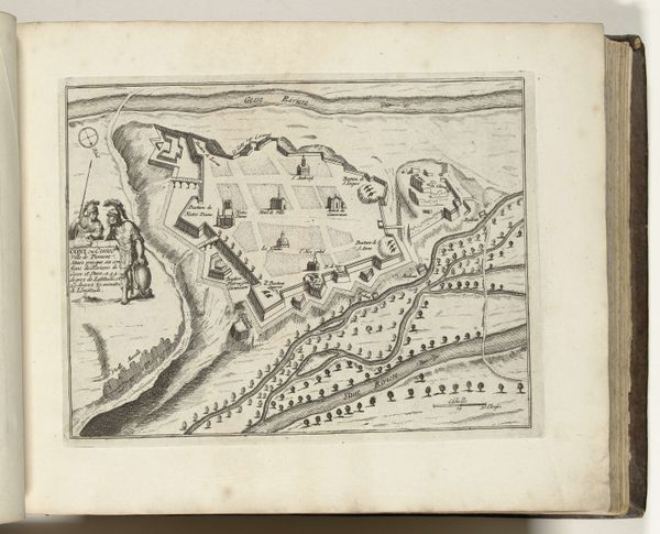
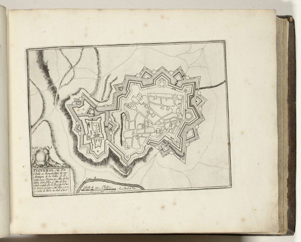
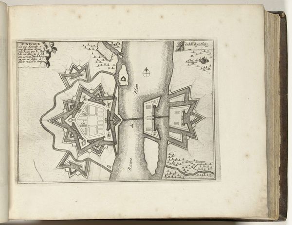
drawing, print, ink, engraving
#
drawing
#
baroque
# print
#
landscape
#
ink
#
geometric
#
engraving
Dimensions: height 213 mm, width 283 mm
Copyright: Rijks Museum: Open Domain
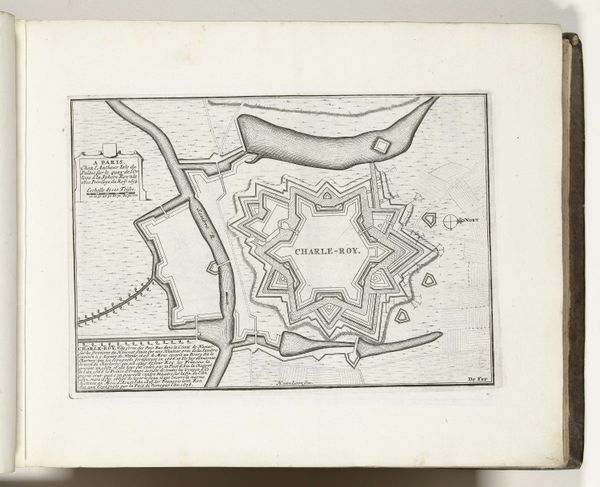
Curator: Alright, let's unravel this cartographic marvel. Editor: So, here we have "Plattegrond van Fort Louis, ca. 1695", dating from around 1695 to 1697. It's attributed to an Anonymous artist, a print drawing with ink and engraving. The overall effect is strangely beautiful – such meticulous detail rendered for purposes of…well, what exactly *was* the purpose? What do you see in this piece, that maybe I'm missing? Curator: Missing? Darling, you’re seeing strategy immortalized. It's more than a map; it's a whisper of power, a blueprint for dominance! Each line of ink traces not just geography but ambition, wouldn't you say? Can you feel it? Editor: A bit…chilly, perhaps? But it’s a beautiful chill. It reminds me of detailed architectural drawings, almost like blueprints of utopia, only, as you point out, militaristic. Curator: Precisely! Think of the mindset: commanding, controlling… almost godlike in its perspective. The Baroque loved drama. Even in maps, there’s that flair for spectacle! Now, what do you think, does this change how we should see this, do you think? Editor: I hadn't really thought about drama within a map, but now I see it. It really does open up a new window on that period! Seeing the planning and intent. Curator: It whispers of secret pacts, of borders redrawn, and the rise and fall of empires. Who knew so much story could hide within the lines of a map? Editor: Definitely something to remember when viewing maps – to look for those stories. Thank you.
Comments
No comments
Be the first to comment and join the conversation on the ultimate creative platform.
More like this