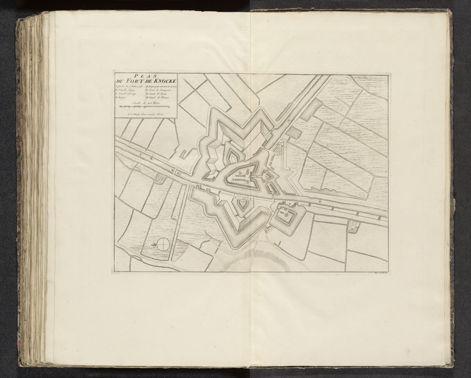
1727 - 1729
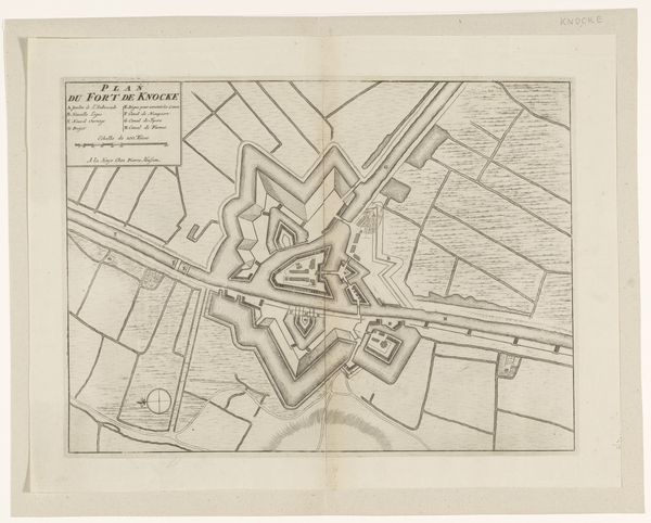
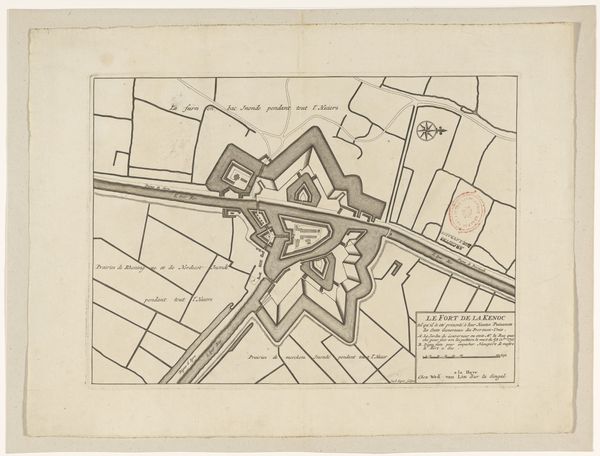
Plattegrond van Fort Knokke, 1712
Anonymous
@anonymousLocation
RijksmuseumListen to curator's interpretation
Curatorial notes
This is an anonymous 1712 drawing titled "Plattegrond van Fort Knokke" at the Rijksmuseum. Its lines are precise, geometric, and evoke a sense of order and control. The structure centers around the fort itself, its star shape rendered with meticulous accuracy. This form, repeated and mirrored, presents a visual language of defense and strategic planning. The artist uses line to demarcate space, creating a semiotic system where each shape signifies a specific function, from protective walls to open fields. The composition reveals not just a physical space but also an intellectual one, where power is mapped and controlled through representation. The stark contrast between the fort's controlled geometry and the organic shapes of the surrounding landscape highlights the tension between human order and natural form. It reflects a period where cartography was as much about claiming territory as it was about recording it.