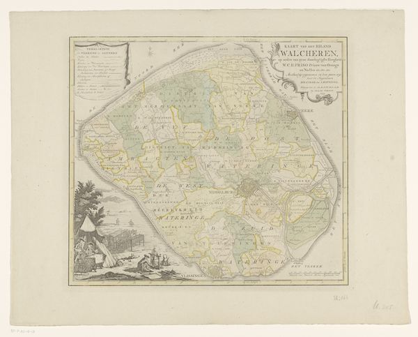
graphic-art, print, etching, engraving
#
graphic-art
#
baroque
# print
#
etching
#
landscape
#
etching
#
engraving
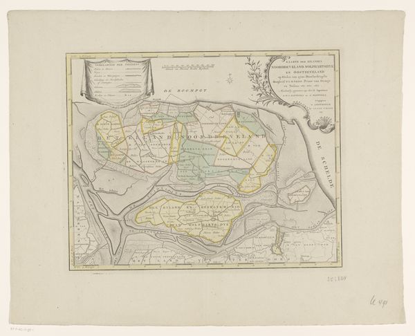
Dimensions: height 336 mm, width 635 mm
Copyright: Rijks Museum: Open Domain
Curator: Here we have an intriguing map, "Kaart van het eiland Zuid-Beveland," dating back to sometime between 1753 and 1760. It's presented as a detailed print, incorporating both etching and engraving techniques. Editor: Immediately striking is the delicate coloration—a muted palette lends it a somewhat somber, yet elegant mood. The linear precision is compelling too, dictating the forms and the relationships among spaces. Curator: Indeed. This wasn't merely about geographic representation; it's intertwined with power structures and social constructs. Consider how meticulously the region is divided—parishes marked, denoting land ownership and ecclesiastical influence, reflective of the social hierarchy of the time. The map would likely have been used by the elite to administer, control, and even extract resources from the area. Editor: Absolutely, the structural clarity and imposed divisions serve as more than just navigational assistance. Look at the strategic use of lines and varied textures created by etching and engraving; see how they emphasize specific areas while others fade slightly, creating a hierarchy on the surface. Semiotics could yield powerful data for spatial hierarchy Curator: The inclusion of the people pictured offers fascinating socio-political insight, positioned just so next to what’s designated as Beverland. What we might assume is pure landscape isn’t that at all. It's overlaid with complex symbolism pertaining to regional governance, the livelihoods of the population, and the delicate tension between land and sea. The baroque flourishes too, in the title cartouche. It highlights the artist's agenda. Editor: Quite! Even the paper choice itself, aged yet resilient, adds to the map’s presence. The format gives structure, a key element when engaging with its forms of spatial division Curator: So, rather than viewing it as a simple record, let's contemplate how this map was—and is—a tool of authority, shaping perceptions and controlling access. Editor: A beautiful example, structurally rich but conceptually deep and informative too. I noticed new connections between medium and historical moment as well.
Comments
No comments
Be the first to comment and join the conversation on the ultimate creative platform.
More like this