print, etching
#
dutch-golden-age
# print
#
etching
#
landscape
#
etching
Dimensions: height 499 mm, width 658 mm
Copyright: Rijks Museum: Open Domain
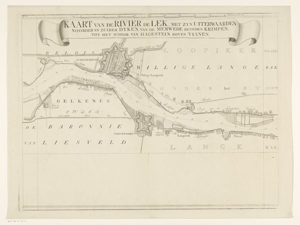
Editor: Here we have "Kaart van de rivier de Lek (eerste deel)" – that’s "Map of the Lek River (first part)" – etched by Isaak Tirion between 1764 and 1765. Looking at the lines and details, it strikes me how meticulously the landscape has been captured. What stands out to you? Curator: I see the intense labour embedded in the printmaking process itself. Etching requires careful planning, the skilled manipulation of materials – acid, metal plates, ink – and immense physical work. It transforms the immediate, flowing reality of the river into a reproducible object of knowledge and, perhaps, control. Editor: Control? Curator: Yes. Mapping was essential to Dutch mercantile power. Note the clear delineation of waterways and land divisions. These weren't simply aesthetic choices; they directly supported resource extraction, trade, and the control of territory. How do you read the relationship between nature and culture based on this print? Editor: I suppose it's easy to see nature here – the river – but maybe we’re really looking at the material and social implications of land ownership and its impact on natural resources. The etching itself becomes a kind of commodity, mirroring the economic imperatives behind its creation. Curator: Precisely! It blurs traditional boundaries of art, craftsmanship and utility by focusing on the act of making and its consequences within its social-economic conditions. Editor: So, thinking about the artist's choices and techniques reveals the economic forces shaping not just the landscape, but also the art depicting it. I will think of maps in a new way now.
Comments
No comments
Be the first to comment and join the conversation on the ultimate creative platform.
More like this