print, engraving
#
dutch-golden-age
# print
#
landscape
#
geometric
#
history-painting
#
engraving
Dimensions: height 278 mm, width 325 mm
Copyright: Rijks Museum: Open Domain
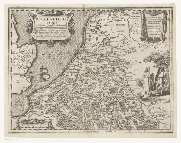
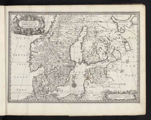
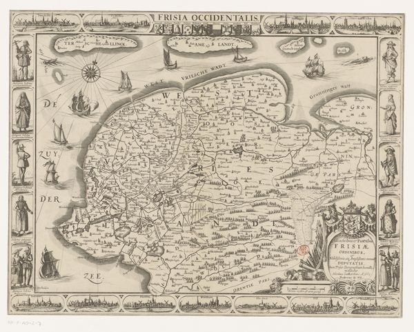
Curator: What a fantastically detailed engraving. This is "Kaart van het graafschap Holland," or "Map of the County of Holland," dating from between 1611 and 1614, created by an anonymous artist. It’s an exquisite example of early Dutch cartography. Editor: It certainly is intricate! The dense network of lines creates a very textured surface, almost a fabric. The script, too, has such a calligraphic quality; its loops and flourishes add an elegance to the document. Curator: Absolutely. During this period, the Dutch Golden Age was in full swing, and maps like this were not only navigational tools, they were symbols of status and power. Possessing detailed knowledge of the land, especially during a time of immense trade and territorial expansion, meant control. The precision of this piece reflects the rising importance of empirical observation and scientific accuracy in Dutch society. Editor: Looking closely, I am fascinated by the tension between the overall geometric grid and the organic, meandering coastlines. Notice how the waterways carve their way into the land, creating complex, almost fractal patterns? This contrast is visually very compelling, drawing the eye into a dance between order and nature. Curator: Indeed. These maps served as a crucial record of geographic and political landscapes for a burgeoning merchant class, facilitating trade routes and asserting Dutch claims over newly acquired territories. And if you observe how “Mare Germanicum” sprawls across the top left, you will also notice how they would subtly indicate who was thought to possess control of which seas. Editor: And also notice the way the cartographer handles scale. It seems less about absolute accuracy and more about presenting information, privileging the symbolic representation of key landmarks and urban centres. Curator: That is spot on. These maps not only show us the physical geography of the land, they narrate the rise of Dutch power, prosperity, and intellectual prowess during one of its most pivotal historical moments. Editor: I am just still admiring the balanced distribution of tonal values here, ranging from dark, densely engraved areas to the pristine, untouched paper. Curator: Yes, quite the synthesis of artistic vision and a societal projection of territorial awareness and aspirations. Editor: Well, it has certainly given me a greater sense of the integration of cartography and social ambition.
Comments
No comments
Be the first to comment and join the conversation on the ultimate creative platform.
More like this