graphic-art, print, engraving
graphic-art
engraving
Dimensions: height 456 mm, width 362 mm
Copyright: Rijks Museum: Open Domain
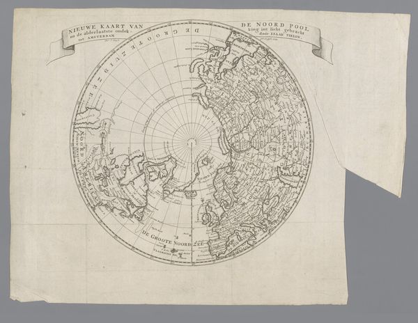
This is an anonymous world map showing the Eastern Hemisphere. The map's circular form echoes the medieval 'mappa mundi,' a symbolic representation of the world as understood through a religious lens, with Jerusalem often at its center. This circular motif, repeated in the depiction of Antarctica, reminds us of our attempts to capture the infinite, to make the unknown known. Consider the symbolic weight of cartography itself. Maps are not mere representations of land; they are projections of power, knowledge, and cultural perspective. Africa, prominently displayed, evokes the age of exploration and colonial ambition. Note how these territories are colored, almost claiming the land. Think of how these visualizations shape our collective memory. The map becomes a powerful tool, influencing our understanding of geography and history. The allure of the unknown, the desire to chart new territories, remains a potent force, subtly guiding our perceptions and actions.
Comments
No comments
Be the first to comment and join the conversation on the ultimate creative platform.