painting, watercolor
#
medieval
#
painting
#
watercolor
#
geometric
#
cityscape
#
watercolour illustration
Dimensions: height 178 mm, width 284 mm, height 532 mm, width 320 mm
Copyright: Rijks Museum: Open Domain
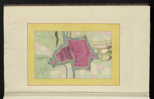
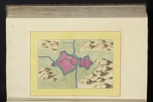
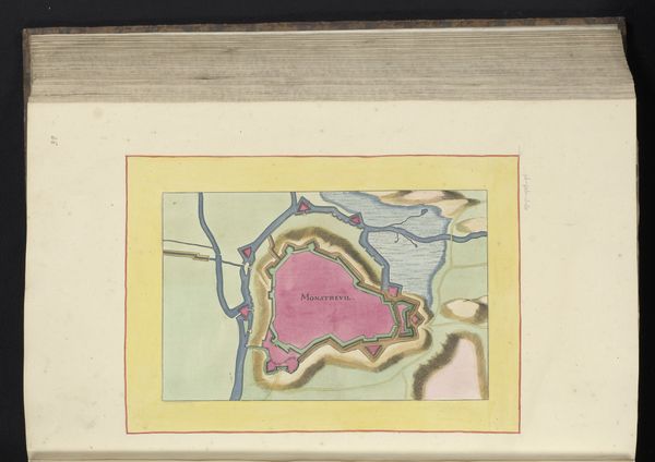
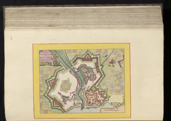
Curator: Here we have an anonymous work from 1656, entitled "Vestingplattegrond van Abbeville," which translates to something like "Fortified Map of Abbeville." It's held in the collection of the Rijksmuseum. Editor: It’s striking how this watercolor, though seemingly objective, creates such an odd atmosphere. The color palette, especially the bold pink for the town itself, feels almost dreamlike. The controlled lines and geometric layout, that too. What a contradiction! Curator: Maps such as these served a critical purpose beyond mere navigation. They were tools of power, projecting control and strategic advantage. Abbeville's fortified design underscores the constant threat of conflict in 17th-century Europe. Note how the outer structures highlight the separation from the agrarian world outside. Editor: Yes, that's very much the feel of the painting. And consider the materials—watercolor allows for detailed rendering of the landscape, but its translucence also lends an ethereal quality. The artist likely chose it to suggest both precision and perhaps a subtle layer of propaganda. The paper itself also would have been a valuable commodity, a symbol of the patron's wealth. Curator: Indeed, maps also had a potent role in shaping civic identity. This plattegrond likely circulated amongst the city’s elite, reinforcing their position. Look at how the waterways become arterial—power and commerce flowing through Abbeville. Editor: Precisely. It’s about controlling and manipulating resources and perceptions. The execution here tells its own story. The sharp details demand intense labour, reflecting social divisions—the commissioner able to have this crafted while the cartographer executes according to needs. Curator: Studying it, it reveals much about the city's political, social, and even its environmental concerns at the time. Beyond just spatial awareness, there is the implied historical understanding in these decisions of rendering and design. Editor: It makes you wonder about the physical labor and skills— the handwork that created this image— juxtaposed against its purpose as an emblem of civic power. Food for thought.
Comments
No comments
Be the first to comment and join the conversation on the ultimate creative platform.
More like this