drawing, paper, watercolor
#
drawing
#
dutch-golden-age
#
landscape
#
paper
#
watercolor
#
coloured pencil
#
cityscape
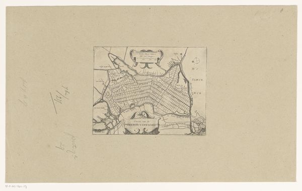
Dimensions: height 183 mm, width 282 mm, height 532 mm, width 320 mm
Copyright: Rijks Museum: Open Domain
This is an anonymous vestingplattegrond, or fortification plan, of Rue, made with pen and watercolor. This image offers a glimpse into the military strategies and urban planning considerations of its time. The walled city is depicted in the center, surrounded by fields. The city's fortifications, rendered in a pale blue hue, indicate the importance of defense in the face of potential conflict. Such plans were crucial for military engineers and rulers in the early modern period, aiding in the design and reinforcement of urban centers against attack. Understanding the history of cartography and military architecture helps us appreciate how political power and geographic knowledge intersected. Resources, such as military archives and period maps, shed light on the circumstances in which this image was produced, allowing for a richer interpretation of its cultural and historical significance.
Comments
No comments
Be the first to comment and join the conversation on the ultimate creative platform.
More like this