drawing, paper, ink
#
drawing
#
baroque
#
paper
#
ink
#
cityscape
#
genre-painting
Dimensions: height 397 mm, width 543 mm
Copyright: Rijks Museum: Open Domain
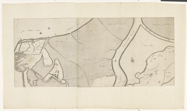
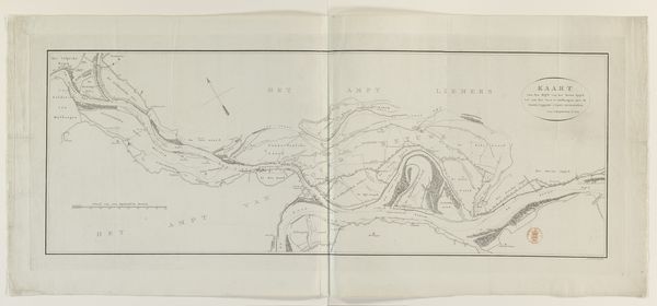
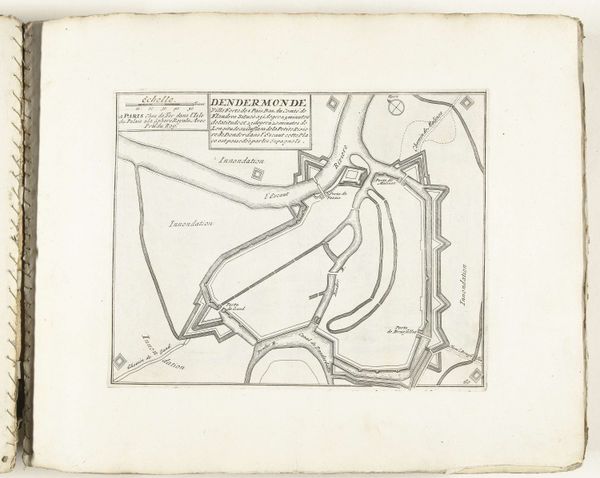
Samuel Du Ry de Champdoré created this map of Dendermonde with pen and watercolor, around 1701-1715. Champdoré, born to a family of military engineers, carried on the tradition in service to the Dutch States Army. This map offers us a glimpse into a world of territorial disputes and military strategy. It was a period marked by frequent conflicts, and these maps were vital tools for planning defenses and understanding landscapes. Champdoré's map depicts not just geographical features but also political power. During his lifetime, the balance of power shifted dramatically. Dendermonde, located in a region contested between the Dutch Republic and the Spanish Netherlands, was a strategic stronghold. This map highlights the architecture of military might, reflecting the ongoing power struggles. By studying such maps, we gain insight into the social, political, and military structures of the time. While seemingly technical, they deeply reflect issues of identity, power, and survival.
Comments
No comments
Be the first to comment and join the conversation on the ultimate creative platform.
More like this