graphic-art, print, paper, engraving
#
graphic-art
#
dutch-golden-age
# print
#
landscape
#
paper
#
engraving
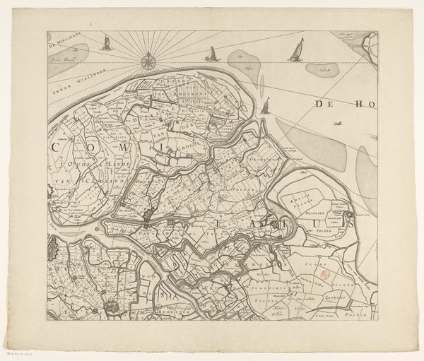
Dimensions: height 466 mm, width 534 mm
Copyright: Rijks Museum: Open Domain
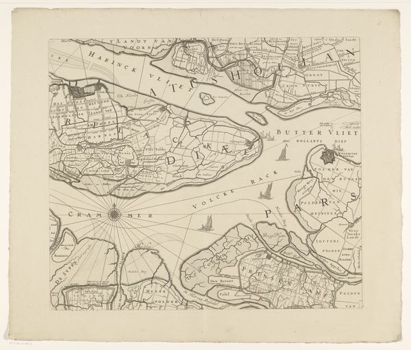
Curator: Here we have "Kaart van Zeeland (vierde deel)", a section of a map of Zeeland, dating from between 1655 and 1725. It’s an engraving on paper, showcasing a landscape in the Dutch Golden Age style. Editor: The intricacy of the linework immediately grabs me. The density and the way the crosshatching defines form—it’s a compelling texture, especially considering the purpose is primarily informational. It has an aesthetic value, I think. Curator: Absolutely. It's fascinating how maps in this era served multiple purposes. They were tools for navigation and governance but also projections of power and national identity. Note how meticulously the landscape is detailed, demonstrating Dutch mastery over land and water. Editor: I’m drawn to the way the engraver differentiates land from water, not just through literal representation, but almost symbolically. The land appears worked, cultivated, while the sea is looser, wilder. A clear delineation. Curator: Yes, and consider Zeeland's strategic importance. The map highlights fortified towns, shipping routes—a reflection of the intense naval and mercantile activity that defined the Dutch Golden Age. Editor: Also the inclusion of ships isn't just incidental. It's almost like asserting presence, underscoring Dutch maritime strength. From a visual standpoint, those tiny vessels create visual energy, offsetting the rigidity of the grid-like landscape. Curator: The printing also allows for widespread distribution, so the government or merchants can spread information faster than ever. We are truly getting to experience how powerful controlling space can be. Editor: Seeing this meticulous cartography, you appreciate how form and function become so powerfully intertwined. It transcends its informational intent. It's art, propaganda, and record all at once. Curator: And considering the history of Zeeland—the constant struggle against the sea—this map almost feels like a declaration of resilience. Editor: It's like a promise captured in ink. That’s quite a lot to find on paper.
Comments
No comments
Be the first to comment and join the conversation on the ultimate creative platform.
More like this