drawing, print, engraving
#
drawing
#
baroque
# print
#
linocut print
#
cityscape
#
engraving
Dimensions: height 104 mm, width 151 mm, height 532 mm, width 320 mm
Copyright: Rijks Museum: Open Domain
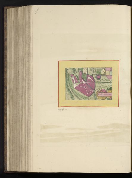
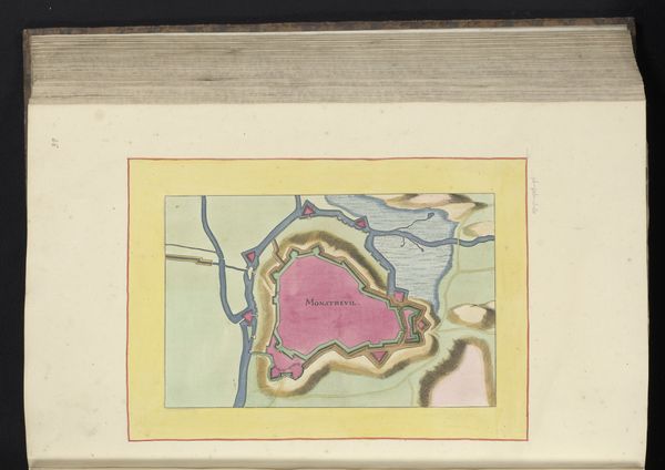
Editor: Here we have an engraved map titled "Plattegrond van Saint-Jean-d'Angély" created around 1638. The bright pink colouration of the town itself really jumps out. What strikes you most about the visual construction of this piece? Curator: Indeed, the immediate impact lies in the chromatic contrast between the pink fortified town and the verdant surroundings. Let us observe how the engraver manipulates line weight to define form and texture. Note, for example, the meticulous hatching used to render the landscape compared to the solid blocks delineating the urban space. How do you perceive this interplay? Editor: I see it as a way to emphasize the separation of the town from the surrounding area. It is like the artist is using texture to enhance the concept of 'fortified'. Is there something to be learned from that particular effect? Curator: Precisely. The stark distinction compels us to contemplate the intended semiotic function of these visual elements. Observe also the strategic placement of linear breaks along the fortification lines. The intention of this fragmentation could underscore vulnerability. How does this interplay of formal devices resonate with a potentially turbulent historical setting? Editor: It really pushes me to consider what the map communicates visually beyond just directions. Thank you, I had not considered that at all. Curator: These graphic techniques encourage active engagement, prompting one to analyse and interpret. An artwork may be more than the image itself and must invite deeper thinking.
Comments
No comments
Be the first to comment and join the conversation on the ultimate creative platform.
More like this