painting, watercolor
#
baroque
#
painting
#
watercolor
#
cityscape
#
history-painting
Dimensions: height 212 mm, width 279 mm, height 532 mm, width 320 mm
Copyright: Rijks Museum: Open Domain
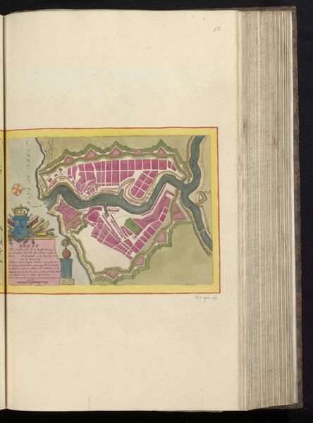
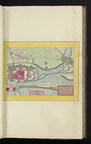
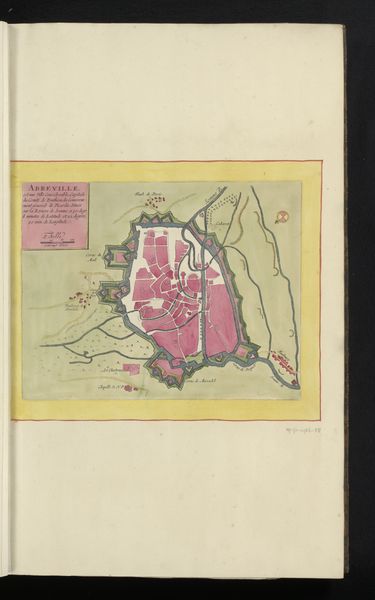
This anonymous map of Saint-Malo offers a glimpse into the intertwined worlds of maritime power and urban planning. Made during a time of intense naval competition, most likely in the 17th or 18th century, the map reveals Saint-Malo as a strategic stronghold, its fortifications jutting defiantly into the sea. The walled city, rendered in striking pink, becomes a symbol of French ambition. Consider how maps like this weren't just about geographical accuracy. They were tools of power, shaping perceptions and justifying territorial claims. The inclusion of figures along the lower edge hints at the human labor and military might required to maintain such a fortress. Analyzing such an image calls for a look into period archives. What were France’s specific strategic goals at this time, and how did Saint-Malo fit into the broader geopolitical landscape? Through such investigations, we can understand this map as a visual artifact deeply embedded in the social and institutional contexts of its time.
Comments
No comments
Be the first to comment and join the conversation on the ultimate creative platform.
More like this