watercolor
#
baroque
#
watercolor
#
cityscape
Dimensions: height 103 mm, width 150 mm, height 532 mm, width 320 mm
Copyright: Rijks Museum: Open Domain
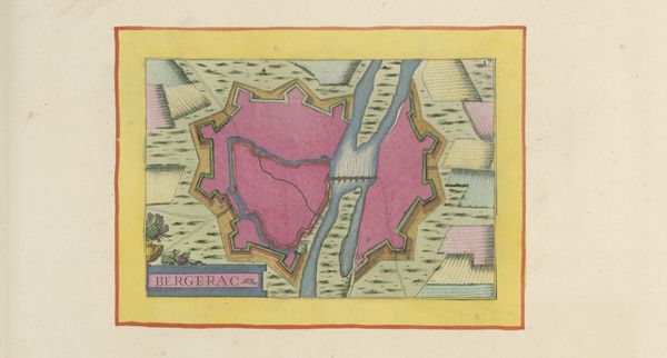
This "Plattegrond van Navarrenx," or map of Navarrenx, was made anonymously using ink and paint on paper. The map's creation involved a combination of technical skill and artistic rendering. The neat lines of the fortifications and streets would have required careful planning, precision and measurement. Once the basic structure was drawn, paint was meticulously applied to delineate different areas – pink for the town itself, pale blue for the river, and green for the surrounding fields. The map provides insights into the town's military and social organization. The fortifications emphasize the need for defense, reflecting a time of conflict and territorial disputes. Within these walls, the streets and buildings are arranged in an orderly fashion, revealing a structured society, with civic buildings, and domestic arrangements. This map connects aesthetics, technology, and social history. It’s a reminder that the creation of even seemingly functional objects involves artistic choices and reflects the values and priorities of the society that produced them.
Comments
No comments
Be the first to comment and join the conversation on the ultimate creative platform.
More like this