Curatorial notes
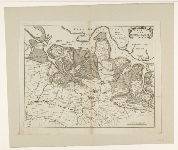
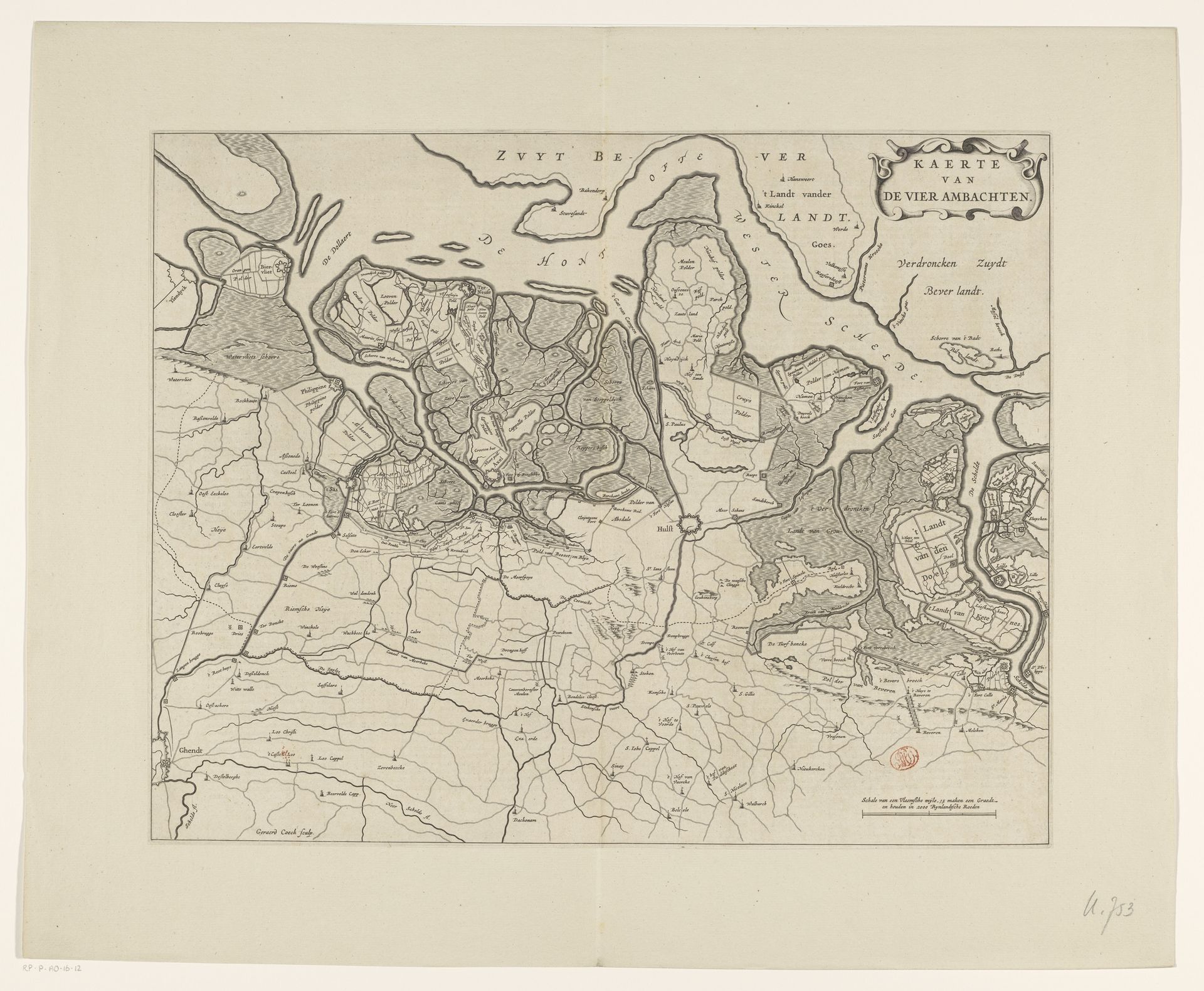
Gerard Coeck produced this map of the Vier Ambachten, with its intricate lines and detailed structure, in the 17th century using engraving techniques. The composition is a delicate balance between land and water, with each element carefully delineated. The lines, acting as boundaries and waterways, define the landscape's spatial relationships. Notice how the varying textures, created through hatching and stippling, give depth and dimension to the land masses. The visual organization isn't just geographical, it's a semiotic system representing control and order. The map functions as a discourse on space, power, and representation, and it is not just an objective record but a constructed narrative. The lines both divide and connect, reflecting how boundaries can simultaneously separate and unite communities. As a result, this cartographic representation embodies larger philosophical discussions about how we understand and interact with our environment.