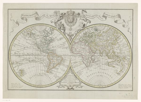
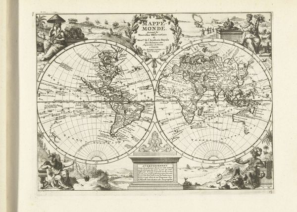
Planiglobii Terrestris Mappa Universalis... 1746
0:00
0:00
drawing, print, engraving
#
drawing
#
baroque
# print
#
genre-painting
#
engraving
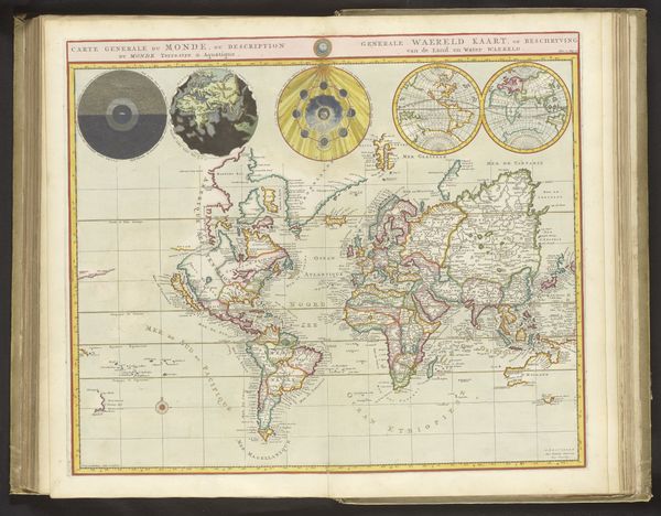
Dimensions: Plate: 18 3/4 × 22 3/8 in. (47.7 × 56.9 cm) Sheet: 21 13/16 × 24 15/16 in. (55.4 × 63.4 cm)
Copyright: Public Domain
Johann Baptist Homann created this hand-colored engraving titled "Planiglobii Terrestris Mappa Universalis..." during a time of burgeoning European exploration and colonization. It reflects an era where mapping was as much about asserting dominance as it was about geographical accuracy. Notice how Europe and parts of Asia are rendered with greater detail, centered and highlighted, a visual cue that subtly reinforces a Eurocentric worldview. This map isn't just a neutral depiction of landmasses; it's a statement about power, knowledge, and the "known world" as defined by European cartographers. What stories are told by what is included, and perhaps even more powerfully, what is left out? Consider how this image might have shaped the perceptions of those who viewed it, influencing their understanding of different cultures and geographies, and solidifying the idea of a world organized around a European center. It's a potent reminder that maps are not objective truths, but rather constructions reflecting the biases and intentions of their creators.
Comments
No comments
Be the first to comment and join the conversation on the ultimate creative platform.
More like this