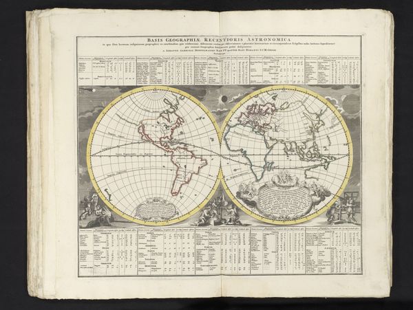
drawing, print, ink, engraving
#
drawing
# print
#
ink
#
geometric
#
history-painting
#
engraving
Dimensions: height 50 mm, width 79 mm
Copyright: Rijks Museum: Open Domain
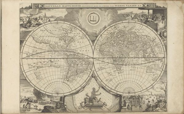
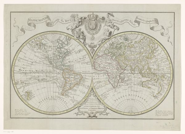
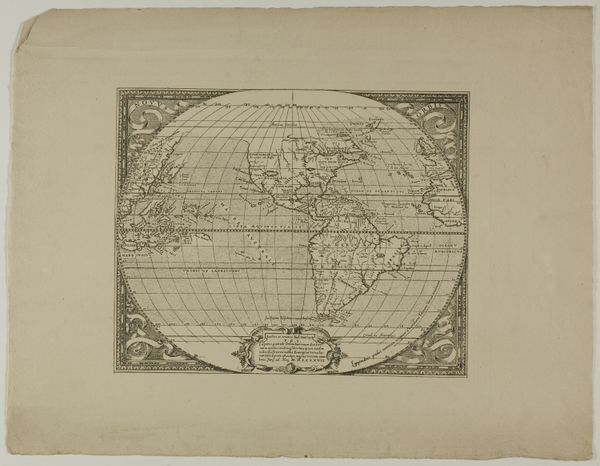
Curator: This fascinating work, created in 1772, is entitled "Wereldkaart," a world map attributed to Abraham van Krevelt of Amsterdam. It’s a drawing, print and engraving featuring ink as the primary medium. Editor: The dual hemisphere presentation is visually striking! There’s a real antique feel, evoking a sense of global exploration. How did maps like this shape the perception of the world for those who viewed them? Curator: These maps reflected a blend of empirical observation and inherited cultural understandings of the world, literally shaping how people imagined their place within it. Representations of continents held immense symbolic power. How they depicted these territories served as more than mere geographic data, becoming imbued with a worldview specific to the period, and, of course, that of the mapmaker. Editor: Given that it's a print, do we know anything about its production context, or where something like this might have been displayed? The material of the ink itself would certainly invite speculations regarding trade routes and accessible colors of the period. Curator: These maps often served multiple purposes—decorative pieces in wealthy homes or essential navigational tools, influencing maritime expansion and trade policies. Symbols like elaborate cartouches or representations of exotic wildlife added layers of meaning. These served to underscore notions of the “known” versus the “unknown”, the colonizer and the colonized. Editor: Examining the ink and the engraved lines reveals much about 18th-century craftsmanship. Considering that engravings are reproducible, the material choices are tied to reaching wider audiences, democratizing—to some extent—access to this type of geographical knowledge, with inherent distortions and worldviews. Curator: Exactly. Every carefully rendered line is testament to cartographic methods—techniques loaded with ideological implications about centers and margins, and civilization and otherness, all through something as supposedly "objective" as a world map. Editor: It’s impressive to see how this single sheet embodies so many layers, intertwining global visions, material realities, and social history. Curator: Indeed. It makes one consider the maps we consult today – what are the cultural imprints they impart on the world around us?
Comments
No comments
Be the first to comment and join the conversation on the ultimate creative platform.
More like this